Cogan night lights from space
Night Light of Cogan (Central Visayas) from space (Philippines) Src. Average luminocity for 10x10km area is 4.7004% and for 50x50km: 3.3411%.
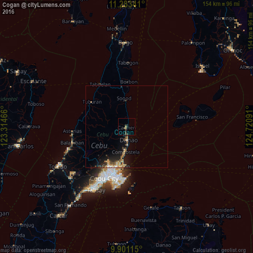

Analysis of Cogan night lights 2016
Square area 10x10 km:
 0%
0%90-99
0%80-89
0.62%70-79
1.03%60-69
0%50-59
0%40-49
3.72%30-39
1.24%20-29
1.45%10-19
1.03%0-9
90.91%Square area 50x50 km:
0.2%90-99
0.24%80-89
0.61%70-79
0.48%60-69
0.66%50-59
0.31%40-49
0.75%30-39
0.43%20-29
1.04%10-19
2.5%0-9
92.78%Clear (daylight) street map image can be seen on geolist.org.
Map coordinates:
11° 17' 0.3" North, 123° 18' 52.8" East
10° 35' 35" North, 124° 1' 4" East
9° 54' 4.1" North, 124° 43' 15.3" East
Some cities around Cogan sort by population:
• Danao
8.1 km =5 mi,  172°
172°
• Liloan
21.7 km =13.5 mi,  185°
185°
• Consolacion
25 km =15.5 mi,  195°
195°
• Compostela
15.4 km =9.6 mi,  182°
182°
• Catmon
13.9 km =8.6 mi,  351°
351°
• Tayud
23.7 km =14.7 mi, 183°
• Nangka
7.4 km =4.6 mi,  229°
229°
• Lunas
29.5 km =18.3 mi,  280°
280°
1718328 (p: 21,898)
Sources (retrieved 2019-11-25):
» Earth at Night: Flat Maps 2012, 2016