Cardona night lights from space
Night Light of Cardona (Calabarzon) from space (Philippines) Src. Average luminocity for 10x10km area is 25.9827% and for 50x50km: 30.8984%.
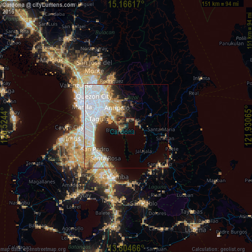

Analysis of Cardona night lights 2016
Square area 10x10 km:
 0%
0%90-99
0%80-89
0.65%70-79
5.41%60-69
5.19%50-59
7.36%40-49
8.66%30-39
12.34%20-29
5.84%10-19
16.45%0-9
38.1%Square area 50x50 km:
11.78%90-99
6.39%80-89
2.37%70-79
5%60-69
3.3%50-59
1.51%40-49
1.87%30-39
3.01%20-29
3.9%10-19
5.62%0-9
55.26%Clear (daylight) street map image can be seen on geolist.org.
Map coordinates:
15° 9' 58.2" North, 120° 31' 27.8" East
14° 29' 11.3" North, 121° 13' 39.1" East
13° 48' 16.8" North, 121° 55' 50.3" East
Some cities around Cardona sort by population:
• Binangonan
4.4 km =2.7 mi,  236°
236°
• Angono
9.1 km =5.7 mi,  299°
299°
• Tanay
6.3 km =3.9 mi,  79°
79°
• Morong
3.7 km =2.3 mi,  17°
17°
• Teresa
8.4 km =5.2 mi,  354°
354°
• Pililla
8.5 km =5.3 mi,  90°
90°
• Baras
5.3 km =3.3 mi,  50°
50°
• Pinugay
12.8 km =8 mi, 16°
1718426 (p: 30,222)
Sources (retrieved 2019-11-25):
» Earth at Night: Flat Maps 2012, 2016