Binangonan night lights from space
Night Light of Binangonan (Calabarzon) from space (Philippines) Src. Average luminocity for 10x10km area is 20.9675% and for 50x50km: 36.5804%.
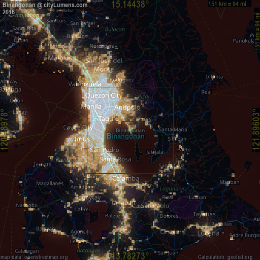
Analysis of Binangonan night lights 2016
Square area 10x10 km:
 0%
0%90-99
0%80-89
0.43%70-79
4.55%60-69
5.63%50-59
5.19%40-49
3.68%30-39
9.31%20-29
6.28%10-19
18.83%0-9
46.1%Square area 50x50 km:
13.74%90-99
7.52%80-89
3.1%70-79
6.44%60-69
3.99%50-59
1.94%40-49
2.29%30-39
3.32%20-29
3.86%10-19
5.67%0-9
48.11%Clear (daylight) street map image can be seen on geolist.org.
Map coordinates:
15° 8' 39.8" North, 120° 29' 23.2" East
14° 27' 52.6" North, 121° 11' 34.4" East
13° 46' 57.8" North, 121° 53' 45.7" East
Some cities around Binangonan sort by population:
• Taytay
12.3 km =7.6 mi,  328°
328°
• Angono
8.1 km =5 mi, 328°
• Tanay
10.5 km =6.5 mi,  70°
70°
• Morong
7.7 km =4.8 mi,  38°
38°
• Teresa
11.1 km =6.9 mi,  14°
14°
• Pililla
12.4 km =7.7 mi,  79°
79°
• Cardona
4.4 km =2.7 mi,  56°
56°
• Baras
9.8 km =6.1 mi,  53°
53°
1725094 (p: 219,204)
Sources (retrieved 2019-11-25):
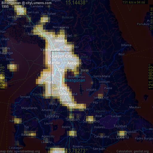
» NASA, Earths city lights 1995
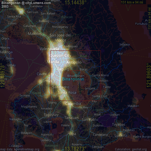
» NASA city lights 2003
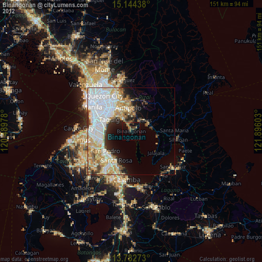
» Earth at Night: Flat Maps 2012, 2016