Pinugay night lights from space
Night Light of Pinugay (Calabarzon) from space (Philippines) Src. Average luminocity for 10x10km area is 13.1558% and for 50x50km: 23.2308%.
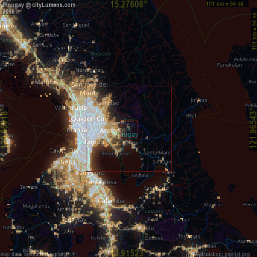
Analysis of Pinugay night lights 2016
Square area 10x10 km:
 0%
0%90-99
0%80-89
0.43%70-79
1.08%60-69
0.87%50-59
1.08%40-49
3.03%30-39
9.96%20-29
8.44%10-19
19.26%0-9
55.84%Square area 50x50 km:
7.25%90-99
4.32%80-89
1.83%70-79
3.95%60-69
3.65%50-59
1.39%40-49
2.03%30-39
3.15%20-29
3.78%10-19
5.41%0-9
63.25%Clear (daylight) street map image can be seen on geolist.org.
Map coordinates:
15° 16' 33.8" North, 120° 33' 33" East
14° 35' 48.1" North, 121° 15' 44.3" East
13° 54' 54.8" North, 121° 57' 55.5" East
Some cities around Pinugay sort by population:
• Angono
14.1 km =8.8 mi,  236°
236°
• Tanay
11.4 km =7.1 mi,  167°
167°
• Morong
9.1 km =5.7 mi,  196°
196°
• Teresa
6.1 km =3.8 mi,  229°
229°
• Pililla
13.2 km =8.2 mi,  159°
159°
• Cardona
12.8 km =8 mi, 196°
• Baras
8.9 km =5.5 mi,  177°
177°
• Sampaloc
12.3 km =7.6 mi,  120°
120°
1693409 (p: 5,666)
Sources (retrieved 2019-11-25):
» Earth at Night: Flat Maps 2012, 2016