Del Pilar night lights from space
Night Light of Del Pilar (Central Luzon) from space (Philippines) Src. Average luminocity for 10x10km area is 54.8244% and for 50x50km: 20.0308%.
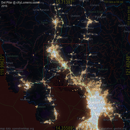
Analysis of Del Pilar night lights 2016
Square area 10x10 km:
 5.79%
5.79%90-99
6.61%80-89
3.93%70-79
20.87%60-69
11.16%50-59
7.23%40-49
7.64%30-39
10.54%20-29
18.18%10-19
8.06%0-9
0%Square area 50x50 km:
0.85%90-99
1.15%80-89
1.6%70-79
5.41%60-69
5.61%50-59
2.27%40-49
4.45%30-39
4.3%20-29
6.75%10-19
12.4%0-9
55.22%Clear (daylight) street map image can be seen on geolist.org.
Map coordinates:
15° 42' 50.3" North, 119° 59' 46.4" East
15° 2' 9.6" North, 120° 41' 57.7" East
14° 21' 21.2" North, 121° 24' 8.9" East
Some cities around Del Pilar sort by population:
• San Fernando
1.6 km =1 mi,  263°
263°
• Bulaon
6.5 km =4 mi,  322°
322°
• Mexico
3.9 km =2.4 mi,  34°
34°
• San Luis
9.6 km =6 mi,  87°
87°
• Minalin
7.8 km =4.8 mi,  193°
193°
• Lourdes
7.9 km =4.9 mi, 192°
• San Jose
9 km =5.6 mi, 91°
• Santo Domingo
6.9 km =4.3 mi,  136°
136°
1715169 (p: 37,329)
Sources (retrieved 2019-11-25):
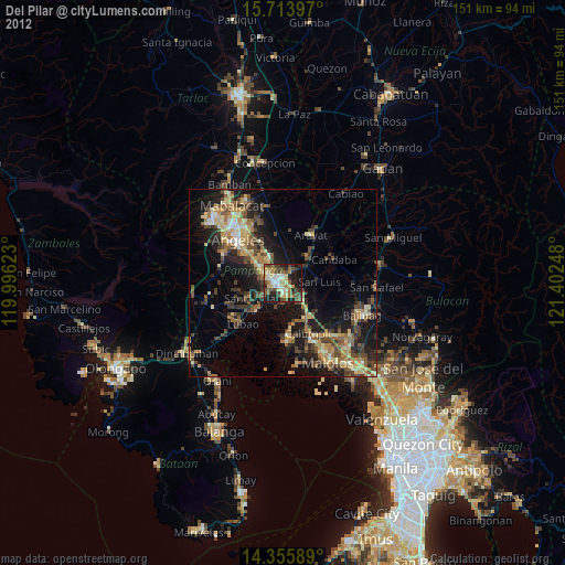
» Earth at Night: Flat Maps 2012, 2016