Loacan night lights from space
Night Light of Loacan (Cordillera) from space (Philippines) Src. Average luminocity for 10x10km area is 0.1446% and for 50x50km: 3.6656%.
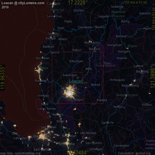
Analysis of Loacan night lights 2016
Square area 10x10 km:
 0%
0%90-99
0%80-89
0%70-79
0%60-69
0%50-59
0%40-49
0%30-39
0%20-29
0%10-19
0%0-9
100%Square area 50x50 km:
0.35%90-99
0.37%80-89
0.62%70-79
1.21%60-69
0.32%50-59
0.23%40-49
0.43%30-39
0.27%20-29
0.88%10-19
3.16%0-9
92.16%Clear (daylight) street map image can be seen on geolist.org.
Map coordinates:
17° 13' 22.1" North, 119° 57' 48.8" East
16° 33' 0" North, 120° 40' 0" East
15° 52' 29.4" North, 121° 22' 11.3" East
Some cities around Loacan sort by population:
• Baguio
16.8 km =10.4 mi,  207°
207°
• La Trinidad
13.5 km =8.4 mi,  218°
218°
• Itogon
20.7 km =12.9 mi,  176°
176°
• Baculongan
33 km =20.5 mi,  32°
32°
• Kibungan
16.2 km =10.1 mi,  355°
355°
• Tuding
15.7 km =9.8 mi,  189°
189°
• Buguias
25.8 km =16 mi,  41°
41°
• Lloren
34.7 km =21.6 mi,  225°
225°
1705905 (p: 6,371)
Sources (retrieved 2019-11-25):
» Earth at Night: Flat Maps 2012, 2016