Ajuy night lights from space
Night Light of Ajuy (Western Visayas) from space (Philippines) Src. Average luminocity for 10x10km area is 0.0022% and for 50x50km: 0.1616%.
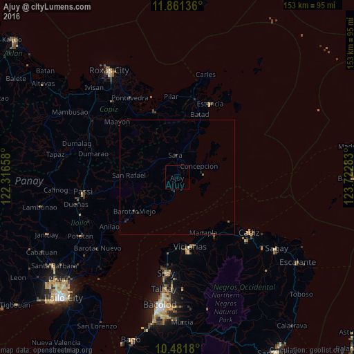
Analysis of Ajuy night lights 2016
Square area 10x10 km:
 0%
0%90-99
0%80-89
0%70-79
0%60-69
0%50-59
0%40-49
0%30-39
0%20-29
0%10-19
0%0-9
100%Square area 50x50 km:
0%90-99
0%80-89
0%70-79
0%60-69
0.03%50-59
0.05%40-49
0.07%30-39
0.06%20-29
0.1%10-19
0.11%0-9
99.58%Clear (daylight) street map image can be seen on geolist.org.
Map coordinates:
11° 51' 40.9" North, 122° 18' 59.7" East
11° 10' 20.6" North, 123° 1' 10.9" East
10° 28' 54.5" North, 123° 43' 22.2" East
Some cities around Ajuy sort by population:
• Victorias
30.6 km =19 mi,  169°
169°
• Manapla
26.4 km =16.4 mi,  154°
154°
• Barotac Viejo
23.3 km =14.5 mi,  231°
231°
• Alicante
30.6 km =19 mi,  180°
180°
• San Pablo
31.8 km =19.8 mi,  155°
155°
• President Roxas
30.4 km =18.9 mi,  340°
340°
• Tortosa
27.7 km =17.2 mi, 163°
• Concepcion
10.7 km =6.6 mi,  63°
63°
1731765 (p: 8,695)
Sources (retrieved 2019-11-25):
» Earth at Night: Flat Maps 2012, 2016