Victorias night lights from space
Night Light of Victorias (Western Visayas) from space (Philippines) Src. Average luminocity for 10x10km area is 10.7792% and for 50x50km: 3.1263%.
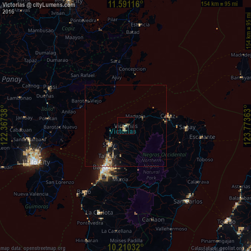
Analysis of Victorias night lights 2016
Square area 10x10 km:
 0.43%
0.43%90-99
1.52%80-89
2.38%70-79
0.43%60-69
2.16%50-59
2.6%40-49
2.6%30-39
1.08%20-29
0.65%10-19
0.87%0-9
85.28%Square area 50x50 km:
0.13%90-99
0.22%80-89
0.51%70-79
0.41%60-69
0.56%50-59
0.54%40-49
0.54%30-39
0.58%20-29
0.84%10-19
2.41%0-9
93.26%Clear (daylight) street map image can be seen on geolist.org.
Map coordinates:
11° 35' 28.2" North, 122° 22' 2.6" East
10° 54' 5.5" North, 123° 4' 13.8" East
10° 12' 37.2" North, 123° 46' 25.1" East
Some cities around Victorias sort by population:
• Binonga
17.4 km =10.8 mi,  213°
213°
• Manapla
8.5 km =5.3 mi,  42°
42°
• Saravia
11.5 km =7.1 mi,  256°
256°
• Eustaquio Lopez
9.7 km =6 mi,  199°
199°
• Dos Hermanas
18.1 km =11.2 mi,  191°
191°
• Alicante
5.7 km =3.5 mi, 264°
• San Pablo
7.9 km =4.9 mi,  81°
81°
• Tortosa
4.1 km =2.5 mi,  31°
31°
1680007 (p: 86,510)
Sources (retrieved 2019-11-25):
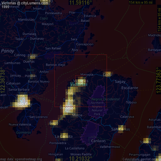
» NASA, Earths city lights 1995
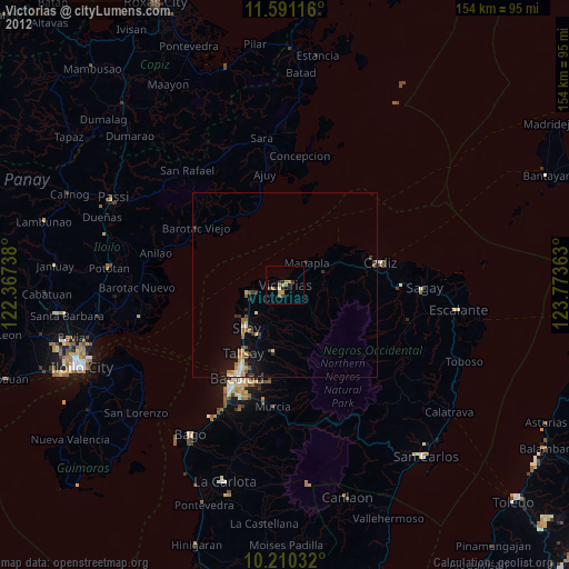
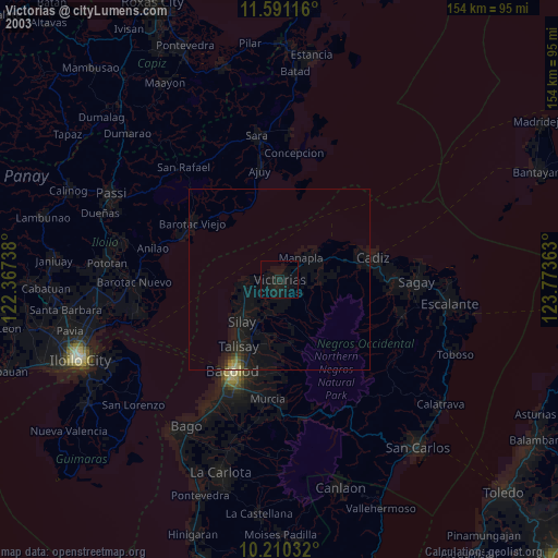
» NASA city lights 2003
» Earth at Night: Flat Maps 2012, 2016