Barotac Viejo night lights from space
Night Light of Barotac Viejo (Western Visayas) from space (Philippines) Src. Average luminocity for 10x10km area is 1.6126% and for 50x50km: 0.8669%.
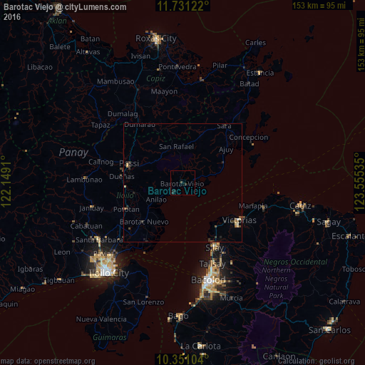
Analysis of Barotac Viejo night lights 2016
Square area 10x10 km:
 0%
0%90-99
0%80-89
0%70-79
0%60-69
0%50-59
0%40-49
1.73%30-39
0.65%20-29
0.43%10-19
1.95%0-9
95.24%Square area 50x50 km:
0.02%90-99
0.06%80-89
0.13%70-79
0.08%60-69
0.1%50-59
0.14%40-49
0.22%30-39
0.38%20-29
0.26%10-19
0.2%0-9
98.41%Clear (daylight) street map image can be seen on geolist.org.
Map coordinates:
11° 43' 52.4" North, 122° 8' 56.8" East
11° 2' 31" North, 122° 51' 8" East
10° 21' 3.7" North, 123° 33' 19.3" East
Some cities around Barotac Viejo sort by population:
• Victorias
28.5 km =17.7 mi,  123°
123°
• Passi
24.1 km =15 mi,  287°
287°
• Saravia
22.2 km =13.8 mi,  145°
145°
• Pototan
26.1 km =16.2 mi,  245°
245°
• Ajuy
23.3 km =14.5 mi,  51°
51°
• Alicante
24.3 km =15.1 mi,  131°
131°
• Dingle
20.3 km =12.6 mi,  256°
256°
• Tumcon Ilawod
24.6 km =15.3 mi,  235°
235°
1726591 (p: 8,611)
Sources (retrieved 2019-11-25):
» Earth at Night: Flat Maps 2012, 2016