Yura night lights from space
Night Light of Yura (Arequipa) from space (Peru) Src. Average luminocity for 10x10km area is 8.5785% and for 50x50km: 12.672%.
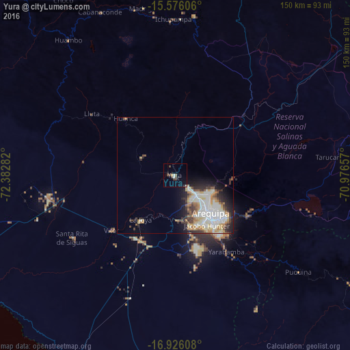
Analysis of Yura night lights 2016
Square area 10x10 km:
 0.83%
0.83%90-99
0.83%80-89
0.41%70-79
0.83%60-69
0%50-59
1.24%40-49
3.72%30-39
1.65%20-29
2.27%10-19
4.13%0-9
84.09%Square area 50x50 km:
2.86%90-99
3.21%80-89
1.81%70-79
1.24%60-69
1.23%50-59
1.19%40-49
1.39%30-39
1.63%20-29
2.65%10-19
3.74%0-9
79.06%Clear (daylight) street map image can be seen on geolist.org.
Map coordinates:
15° 34' 33.8" South, 72° 22' 58.2" West
16° 15' 8" South, 71° 40' 46.9" West
16° 55' 33.9" South, 70° 58' 35.7" West
Some cities around Yura sort by population:
• Arequipa
22.5 km =14 mi,  136°
136°
• Mollendo
92.8 km =57.7 mi,  202°
202°
• Camaná
117.4 km =72.9 mi,  249°
249°
• Cocachacra
93.3 km =58 mi,  185°
185°
• Hacienda Huancane
97.4 km =60.5 mi,  60°
60°
• Torata
127.8 km =79.4 mi, 135°
• Punta de Bombón
103 km =64 mi, 186°
• Lluta
44.4 km =27.6 mi,  306°
306°
3925467 (p: 5,686)
Sources (retrieved 2019-11-25):
» Earth at Night: Flat Maps 2012, 2016