Mollendo night lights from space
Night Light of Mollendo (Arequipa) from space (Peru) Src. Average luminocity for 10x10km area is 20.3939% and for 50x50km: 1.5851%.
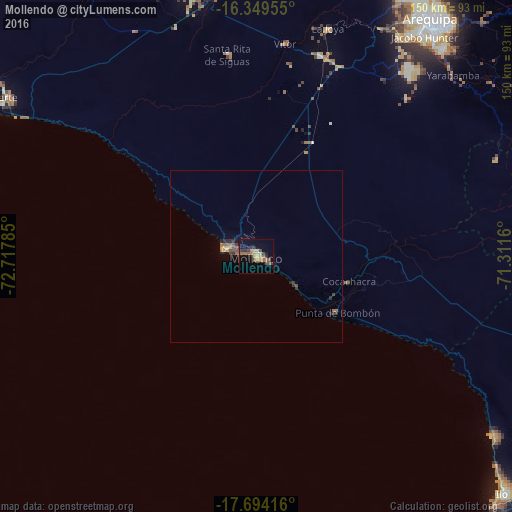
Analysis of Mollendo night lights 2016
Square area 10x10 km:
 0%
0%90-99
0%80-89
3.68%70-79
3.9%60-69
3.68%50-59
6.49%40-49
2.81%30-39
3.68%20-29
3.68%10-19
12.77%0-9
59.31%Square area 50x50 km:
0%90-99
0%80-89
0.2%70-79
0.3%60-69
0.31%50-59
0.39%40-49
0.28%30-39
0.33%20-29
0.49%10-19
0.64%0-9
97.05%Clear (daylight) street map image can be seen on geolist.org.
Map coordinates:
16° 20' 58.4" South, 72° 43' 4.3" West
17° 1' 23" South, 72° 0' 53" West
17° 41' 39" South, 71° 18' 41.8" West
Some cities around Mollendo sort by population:
• Arequipa
86.2 km =53.6 mi,  36°
36°
• Ilo
98.5 km =61.2 mi,  133°
133°
• Camaná
86.3 km =53.6 mi,  300°
300°
• Cocachacra
28.3 km =17.6 mi,  104°
104°
• Pacocha
99.3 km =61.7 mi, 134°
• Punta de Bombón
28.8 km =17.9 mi, 125°
• Lluta
112.1 km =69.7 mi,  0°
0°
• Yura
92.8 km =57.7 mi,  22°
22°
3934707 (p: 28,953)
Sources (retrieved 2019-11-25):
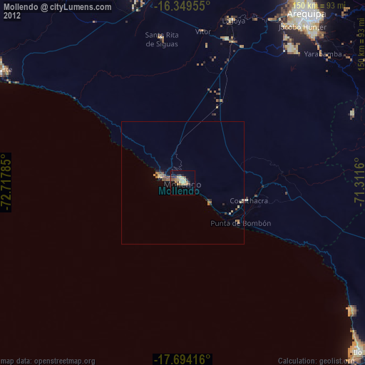
» Earth at Night: Flat Maps 2012, 2016