Arequipa night lights from space
Night Light of Arequipa from space (Peru) Src. Average luminocity for 10x10km area is 96.3368% and for 50x50km: 15.9743%.
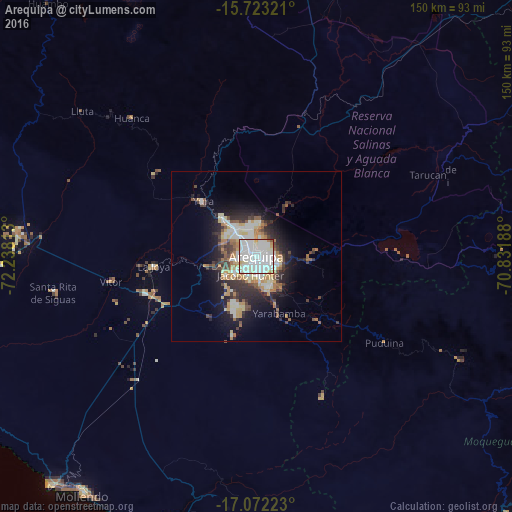
Analysis of Arequipa night lights 2016
Square area 10x10 km:
 46.07%
90-99
41.53%80-89
8.06%70-79
2.07%60-69
1.45%50-59
0.62%40-49
0.21%30-39
0%20-29
0%10-19
0%0-9
0%Square area 50x50 km:
3.09%90-99
3.51%80-89
2.12%70-79
1.78%60-69
1.65%50-59
1.58%40-49
1.83%30-39
2.49%20-29
4.1%10-19
7.44%0-9
70.4%Clear (daylight) street map image can be seen on geolist.org.
Map coordinates:
15° 43' 23.6" South, 72° 14' 17.3" West
16° 23' 56" South, 71° 32' 6" West
17° 4' 20" South, 70° 49' 54.8" West
Some cities around Arequipa sort by population:
• Moquegua
109.4 km =68 mi,  144°
144°
• Mollendo
86.2 km =53.6 mi,  216°
216°
• Cocachacra
80.2 km =49.8 mi,  197°
197°
• Hacienda Huancane
94.4 km =58.7 mi,  47°
47°
• Torata
105.4 km =65.5 mi, 135°
• Punta de Bombón
90.2 km =56 mi, 197°
• Lluta
66.6 km =41.4 mi,  309°
309°
• Yura
22.5 km =14 mi,  316°
316°
3947322 (p: 841,130)
Sources (retrieved 2019-11-25):
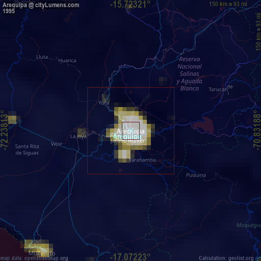
» NASA, Earths city lights 1995
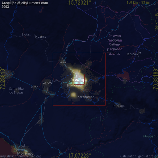
» NASA city lights 2003
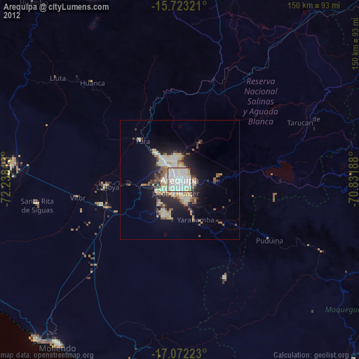
» Earth at Night: Flat Maps 2012, 2016