San Miguel night lights from space
Night Light of San Miguel (Ayacucho) from space (Peru) Src. Average luminocity for 10x10km area is 1.0866% and for 50x50km: 1.0861%.
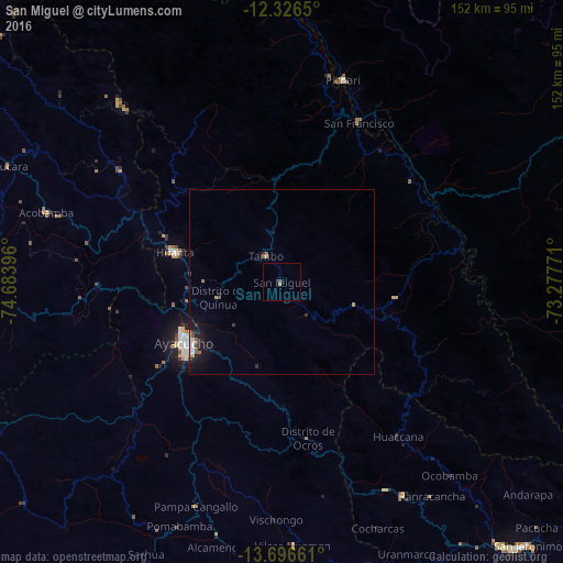
Analysis of San Miguel night lights 2016
Square area 10x10 km:
 0%
0%90-99
0%80-89
0%70-79
0.87%60-69
0%50-59
0.87%40-49
0%30-39
0%20-29
0%10-19
0%0-9
98.27%Square area 50x50 km:
0.14%90-99
0.12%80-89
0.02%70-79
0.2%60-69
0.15%50-59
0.13%40-49
0.13%30-39
0.16%20-29
0.24%10-19
1.31%0-9
97.42%Clear (daylight) street map image can be seen on geolist.org.
Map coordinates:
12° 19' 35.4" South, 74° 41' 2.3" West
13° 0' 45" South, 73° 58' 51" West
13° 41' 47.8" South, 73° 16' 39.8" West
Some cities around San Miguel sort by population:
• Ayacucho
30.9 km =19.2 mi,  238°
238°
• Abancay
137.6 km =85.5 mi,  120°
120°
• Huancavelica
110.5 km =68.7 mi,  283°
283°
• Huanta
30.5 km =19 mi,  286°
286°
• Andahuaylas
96.1 km =59.7 mi,  138°
138°
• Talavera
92.9 km =57.7 mi, 140°
• San Jerónimo
97.5 km =60.6 mi, 136°
• Pampas
118.1 km =73.4 mi,  305°
305°
3929403 (p: 8,400)
Sources (retrieved 2019-11-25):
» Earth at Night: Flat Maps 2012, 2016