Huanta night lights from space
Night Light of Huanta (Ayacucho) from space (Peru) Src. Average luminocity for 10x10km area is 14.9459% and for 50x50km: 1.8986%.
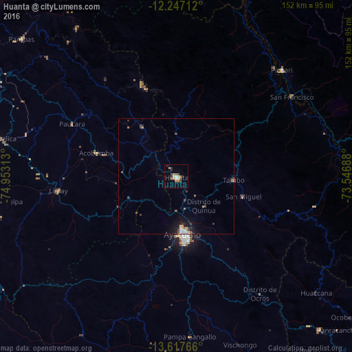
Analysis of Huanta night lights 2016
Square area 10x10 km:
 1.95%
1.95%90-99
2.38%80-89
0%70-79
3.25%60-69
4.33%50-59
0.22%40-49
0.87%30-39
4.33%20-29
1.73%10-19
0%0-9
80.95%Square area 50x50 km:
0.25%90-99
0.22%80-89
0.07%70-79
0.3%60-69
0.31%50-59
0.17%40-49
0.28%30-39
0.46%20-29
0.33%10-19
1.22%0-9
96.38%Clear (daylight) street map image can be seen on geolist.org.
Map coordinates:
12° 14' 49.6" South, 74° 57' 11.3" West
12° 55' 60" South, 74° 15' 0" West
13° 37' 3.6" South, 73° 32' 48.8" West
Some cities around Huanta sort by population:
• Ayacucho
25.2 km =15.7 mi,  173°
173°
• Huancavelica
80.1 km =49.8 mi,  282°
282°
• Andahuaylas
123.1 km =76.5 mi,  130°
130°
• San Miguel
30.5 km =19 mi,  106°
106°
• Talavera
119.6 km =74.3 mi, 132°
• Huayucachi
138.9 km =86.3 mi,  309°
309°
• San Jerónimo
124.8 km =77.5 mi, 129°
• Pampas
89.8 km =55.8 mi, 311°
3939386 (p: 18,627)
Sources (retrieved 2019-11-25):
» Earth at Night: Flat Maps 2012, 2016