Pampas night lights from space
Night Light of Pampas (Huancavelica) from space (Peru) Src. Average luminocity for 10x10km area is 6.186% and for 50x50km: 0.809%.
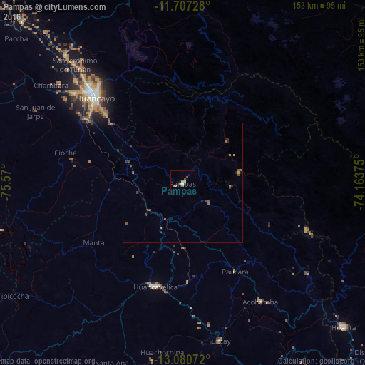
Analysis of Pampas night lights 2016
Square area 10x10 km:
 0.62%
0.62%90-99
0.21%80-89
0%70-79
2.27%60-69
1.86%50-59
0.83%40-49
1.65%30-39
0%20-29
0.83%10-19
1.65%0-9
90.08%Square area 50x50 km:
0.03%90-99
0.01%80-89
0%70-79
0.21%60-69
0.18%50-59
0.29%40-49
0.24%30-39
0.23%20-29
0.13%10-19
0.18%0-9
98.52%Clear (daylight) street map image can be seen on geolist.org.
Map coordinates:
11° 42' 26.2" South, 75° 34' 12" West
12° 23' 41.6" South, 74° 52' 0.7" West
13° 4' 50.6" South, 74° 9' 49.5" West
Some cities around Pampas sort by population:
• Huancayo
51.9 km =32.2 mi,  314°
314°
• Huancavelica
44.6 km =27.7 mi,  194°
194°
• Chupaca
58.1 km =36.1 mi, 308°
• San Jerónimo
66.6 km =41.4 mi,  317°
317°
• Pilcomay
56.8 km =35.3 mi, 312°
• Sicaya
60.5 km =37.6 mi, 311°
• San Agustin
63.2 km =39.3 mi, 318°
• Huayucachi
49.3 km =30.6 mi, 306°
3933185 (p: 5,521)
Sources (retrieved 2019-11-25):
» Earth at Night: Flat Maps 2012, 2016