San Pedro night lights from space
Night Light of San Pedro (La Paz) from space (Bolivia) Src. Average luminocity for 10x10km area is 2.5372% and for 50x50km: 1.1038%.
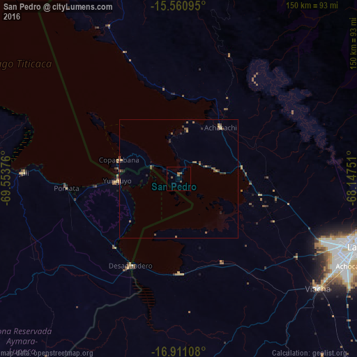
Analysis of San Pedro night lights 2016
Square area 10x10 km:
 0%
0%90-99
0%80-89
0%70-79
0%60-69
0.83%50-59
1.03%40-49
2.27%30-39
0%20-29
0.83%10-19
0%0-9
95.04%Square area 50x50 km:
0%90-99
0%80-89
0.09%70-79
0.21%60-69
0.22%50-59
0.38%40-49
0.41%30-39
0.19%20-29
0.3%10-19
0.17%0-9
98.03%Clear (daylight) street map image can be seen on geolist.org.
Map coordinates:
15° 33' 39.4" South, 69° 33' 13.5" West
16° 14' 13.8" South, 68° 51' 2.3" West
16° 54' 39.9" South, 68° 8' 51" West
Some cities around San Pedro sort by population:
• La Paz
80.3 km =49.9 mi,  111°
111°
• Puno, PE
132.4 km =82.3 mi,  289°
289°
• Yunguyo, PE
24.9 km =15.5 mi,  266°
266°
• Ilave, PE
88.8 km =55.2 mi,  281°
281°
• Achacachi
27.4 km =17 mi,  40°
40°
• Putina, PE
105 km =65.2 mi,  323°
323°
• Juli, PE
64 km =39.8 mi, 272°
• Desaguadero, PE
41.8 km =26 mi,  209°
209°
3905159 (p: 5,002)
Sources (retrieved 2019-11-25):
» Earth at Night: Flat Maps 2012, 2016