Huayucachi night lights from space
Night Light of Huayucachi (Junin) from space (Peru) Src. Average luminocity for 10x10km area is 37.5455% and for 50x50km: 8.9431%.
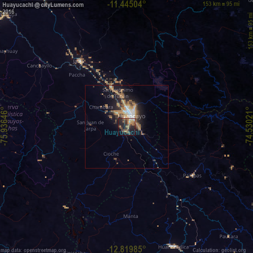
Analysis of Huayucachi night lights 2016
Square area 10x10 km:
 1.03%
1.03%90-99
3.93%80-89
2.89%70-79
7.64%60-69
8.68%50-59
7.23%40-49
9.71%30-39
7.02%20-29
20.66%10-19
17.15%0-9
14.05%Square area 50x50 km:
0.75%90-99
0.9%80-89
0.47%70-79
2.28%60-69
2.07%50-59
1.15%40-49
1.47%30-39
1.62%20-29
2.56%10-19
6.46%0-9
80.27%Clear (daylight) street map image can be seen on geolist.org.
Map coordinates:
11° 26' 42.1" South, 75° 56' 11.3" West
12° 7' 60" South, 75° 13' 60" West
12° 49' 11.5" South, 74° 31' 48.8" West
Some cities around Huayucachi sort by population:
• Huancayo
8.2 km =5.1 mi,  22°
22°
• Jauja
49 km =30.4 mi,  324°
324°
• Concepción
25.5 km =15.8 mi,  339°
339°
• Chupaca
9.2 km =5.7 mi, 323°
• San Jerónimo
20.5 km =12.7 mi, 344°
• Pilcomay
9.7 km =6 mi,  349°
349°
• Sicaya
12.4 km =7.7 mi,  333°
333°
• San Agustin
18.1 km =11.2 mi, 352°
3938819 (p: 5,827)
Sources (retrieved 2019-11-25):
» Earth at Night: Flat Maps 2012, 2016