Chimbote night lights from space
Night Light of Chimbote (Ancash) from space (Peru) Src. Average luminocity for 10x10km area is 56.7857% and for 50x50km: 6.0257%.
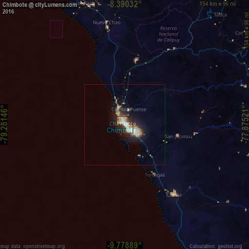
Analysis of Chimbote night lights 2016
Square area 10x10 km:
 11.47%
90-99
14.29%80-89
11.26%70-79
6.28%60-69
6.06%50-59
4.11%40-49
4.76%30-39
6.71%20-29
19.91%10-19
12.99%0-9
2.16%Square area 50x50 km:
0.71%90-99
0.85%80-89
1.02%70-79
0.93%60-69
0.55%50-59
0.53%40-49
0.69%30-39
1.1%20-29
2%10-19
4.83%0-9
86.8%Clear (daylight) street map image can be seen on geolist.org.
Map coordinates:
8° 23' 25.2" South, 79° 16' 53.3" West
9° 5' 7" South, 78° 34' 42" West
9° 46' 44" South, 77° 52' 30.8" West
Some cities around Chimbote sort by population:
• Moche
112.1 km =69.7 mi,  335°
335°
• Virú
76.9 km =47.8 mi,  345°
345°
• Coishco
8 km =5 mi,  329°
329°
• Puerto Santa
13.2 km =8.2 mi, 325°
• Carás
84.6 km =52.6 mi,  87°
87°
• Salaverry
105.6 km =65.6 mi, 335°
• Yungay
91.8 km =57 mi, 93°
• Carhuaz
104.8 km =65.1 mi,  102°
102°
3698304 (p: 316,966)
Sources (retrieved 2019-11-25):
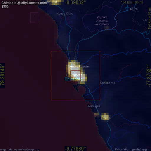
» NASA, Earths city lights 1995
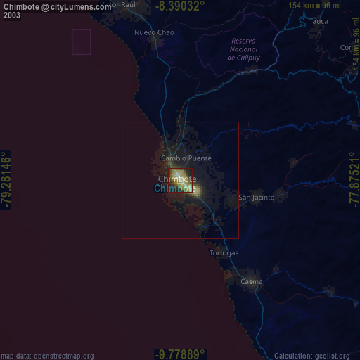
» NASA city lights 2003
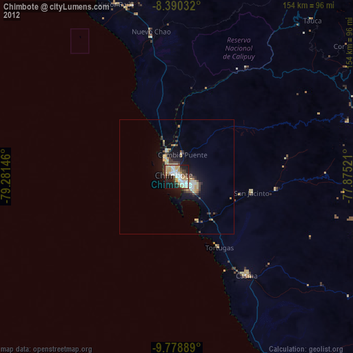
» Earth at Night: Flat Maps 2012, 2016