Salaverry night lights from space
Night Light of Salaverry (La Libertad) from space (Peru) Src. Average luminocity for 10x10km area is 25.2252% and for 50x50km: 10.2864%.
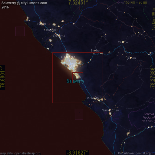
Analysis of Salaverry night lights 2016
Square area 10x10 km:
 0%
0%90-99
0.21%80-89
10.95%70-79
4.55%60-69
4.55%50-59
2.69%40-49
1.65%30-39
2.07%20-29
8.06%10-19
19.42%0-9
45.87%Square area 50x50 km:
1.79%90-99
1.7%80-89
2.78%70-79
0.55%60-69
0.92%50-59
1.08%40-49
1.3%30-39
1.38%20-29
2.52%10-19
5.19%0-9
80.79%Clear (daylight) street map image can be seen on geolist.org.
Map coordinates:
7° 31' 28.2" South, 79° 40' 48.4" West
8° 13' 15.6" South, 78° 58' 37.1" West
8° 54' 58.6" South, 78° 16' 25.9" West
Some cities around Salaverry sort by population:
• Trujillo
13.1 km =8.1 mi,  333°
333°
• Chocope
54.8 km =34.1 mi, 330°
• Laredo
14.7 km =9.1 mi,  7°
7°
• Moche
6.6 km =4.1 mi, 327°
• Santiago de Cao
41 km =25.5 mi,  315°
315°
• Virú
32.9 km =20.4 mi,  131°
131°
• Chicama
45.8 km =28.5 mi,  335°
335°
• Otuzco
56.1 km =34.9 mi,  50°
50°
3692747 (p: 10,066)
Sources (retrieved 2019-11-25):
» Earth at Night: Flat Maps 2012, 2016