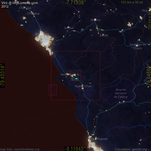
Virú night lights from space
Night Light of Virú (La Libertad) from space (Peru) Src. Average luminocity for 10x10km area is 9.4793% and for 50x50km: 1.342%.
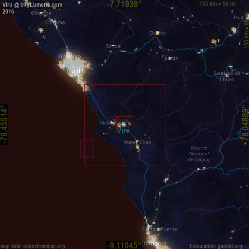
Analysis of Virú night lights 2016
Square area 10x10 km:
 0%
0%90-99
0.21%80-89
3.1%70-79
0%60-69
0%50-59
2.27%40-49
3.51%30-39
3.72%20-29
2.07%10-19
0.83%0-9
84.3%Square area 50x50 km:
0.03%90-99
0.03%80-89
0.24%70-79
0.22%60-69
0.29%50-59
0.16%40-49
0.42%30-39
0.26%20-29
0.32%10-19
0.38%0-9
97.67%Clear (daylight) street map image can be seen on geolist.org.
Map coordinates:
7° 43' 9.8" South, 79° 27' 18.5" West
8° 24' 55.9" South, 78° 45' 7.2" West
9° 6' 37.6" South, 78° 2' 56" West
Some cities around Virú sort by population:
• Trujillo
45.2 km =28.1 mi,  317°
317°
• Laredo
42.9 km =26.7 mi,  327°
327°
• Moche
39.2 km =24.4 mi,  313°
313°
• Coishco
69.2 km =43 mi,  167°
167°
• Puerto Santa
64.7 km =40.2 mi, 169°
• Otuzco
60.3 km =37.5 mi,  17°
17°
• Salaverry
32.9 km =20.4 mi, 311°
• Santiago de Chuco
70.6 km =43.9 mi,  64°
64°
3690875 (p: 20,774)
Sources (retrieved 2019-11-25):
» Earth at Night: Flat Maps 2012, 2016