Carhuaz night lights from space
Night Light of Carhuaz (Ancash) from space (Peru) Src. Average luminocity for 10x10km area is 14.1277% and for 50x50km: 4.1481%.
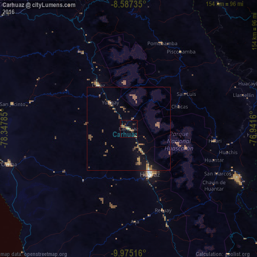
Analysis of Carhuaz night lights 2016
Square area 10x10 km:
 0%
0%90-99
0.22%80-89
0.65%70-79
4.11%60-69
4.98%50-59
1.52%40-49
3.46%30-39
2.38%20-29
3.25%10-19
1.08%0-9
78.35%Square area 50x50 km:
0.03%90-99
0.04%80-89
0.11%70-79
0.92%60-69
0.89%50-59
1.51%40-49
0.99%30-39
0.61%20-29
0.62%10-19
1.69%0-9
92.58%Clear (daylight) street map image can be seen on geolist.org.
Map coordinates:
8° 35' 14.5" South, 78° 20' 52.3" West
9° 16' 55" South, 77° 38' 41" West
9° 58' 30.6" South, 76° 56' 29.8" West
Some cities around Carhuaz sort by population:
• Chimbote
104.8 km =65.1 mi,  282°
282°
• Huaraz
30.2 km =18.8 mi,  154°
154°
• Huarmey
103.6 km =64.4 mi,  212°
212°
• Coishco
110.4 km =68.6 mi,  285°
285°
• Puerto Santa
114.8 km =71.3 mi, 286°
• Carás
31.8 km =19.8 mi,  325°
325°
• Yauya
50.3 km =31.3 mi,  48°
48°
• Yungay
19.3 km =12 mi, 325°
3698814 (p: 5,044)
Sources (retrieved 2019-11-25):
» Earth at Night: Flat Maps 2012, 2016