Celendín night lights from space
Night Light of Celendín (Cajamarca) from space (Peru) Src. Average luminocity for 10x10km area is 8.2879% and for 50x50km: 0.5684%.
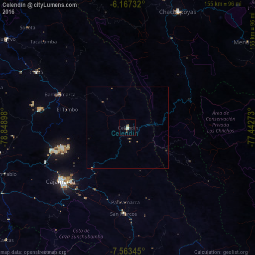
Analysis of Celendín night lights 2016
Square area 10x10 km:
 0.43%
0.43%90-99
2.16%80-89
1.73%70-79
0.87%60-69
0%50-59
1.52%40-49
1.08%30-39
1.73%20-29
0.43%10-19
1.73%0-9
88.31%Square area 50x50 km:
0.02%90-99
0.09%80-89
0.08%70-79
0.13%60-69
0.03%50-59
0.13%40-49
0.06%30-39
0.12%20-29
0.08%10-19
0.16%0-9
99.1%Clear (daylight) street map image can be seen on geolist.org.
Map coordinates:
6° 10' 2.4" South, 78° 50' 56.3" West
6° 51' 57.2" South, 78° 8' 45.1" West
7° 33' 48.4" South, 77° 26' 33.8" West
Some cities around Celendín sort by population:
• Cajamarca
51.3 km =31.9 mi,  229°
229°
• Huamachuco
104.2 km =64.7 mi,  175°
175°
• Chachapoyas
76.9 km =47.8 mi,  23°
23°
• Chota
65.8 km =40.9 mi,  302°
302°
• Cajabamba
84.1 km =52.3 mi,  172°
172°
• Bambamarca
47.4 km =29.5 mi, 295°
• Otuzco
124.7 km =77.5 mi,  202°
202°
• Quiruvilca
122.5 km =76.1 mi, 182°
3698608 (p: 14,660)
Sources (retrieved 2019-11-25):
» Earth at Night: Flat Maps 2012, 2016