Otuzco night lights from space
Night Light of Otuzco (La Libertad) from space (Peru) Src. Average luminocity for 10x10km area is 3.3471% and for 50x50km: 0.6815%.
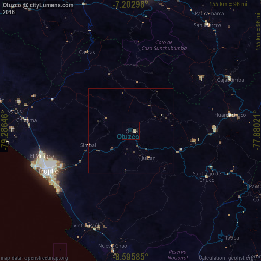
Analysis of Otuzco night lights 2016
Square area 10x10 km:
 0%
0%90-99
1.03%80-89
1.45%70-79
0.83%60-69
0%50-59
0%40-49
0%30-39
0%20-29
0.21%10-19
0.62%0-9
95.87%Square area 50x50 km:
0%90-99
0.04%80-89
0.11%70-79
0.05%60-69
0.11%50-59
0.23%40-49
0.2%30-39
0.17%20-29
0.28%10-19
0.06%0-9
98.75%Clear (daylight) street map image can be seen on geolist.org.
Map coordinates:
7° 12' 10.7" South, 79° 17' 11.3" West
7° 54' 0" South, 78° 34' 60" West
8° 35' 45.1" South, 77° 52' 48.8" West
Some cities around Otuzco sort by population:
• Trujillo
54.7 km =34 mi,  243°
243°
• Laredo
46.5 km =28.9 mi, 243°
• Moche
55.7 km =34.6 mi, 237°
• Huamachuco
58 km =36 mi,  78°
78°
• Virú
60.3 km =37.5 mi,  197°
197°
• Salaverry
56.1 km =34.9 mi,  230°
230°
• Quiruvilca
42.9 km =26.7 mi,  99°
99°
• Santiago de Chuco
52.5 km =32.6 mi,  120°
120°
3694212 (p: 10,134)
Sources (retrieved 2019-11-25):
» Earth at Night: Flat Maps 2012, 2016