Huamachuco night lights from space
Night Light of Huamachuco (La Libertad) from space (Peru) Src. Average luminocity for 10x10km area is 9.686% and for 50x50km: 2.1082%.
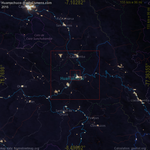
Analysis of Huamachuco night lights 2016
Square area 10x10 km:
 1.65%
1.65%90-99
0.83%80-89
2.89%70-79
0.41%60-69
0.41%50-59
1.65%40-49
1.86%30-39
0.21%20-29
0.83%10-19
0.83%0-9
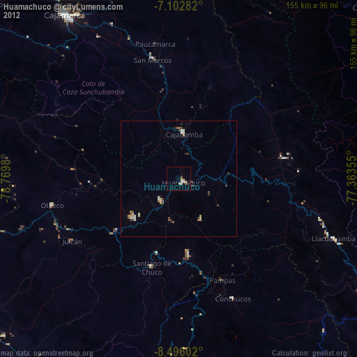
88.43%Square area 50x50 km:
0.07%90-99
0.23%80-89
0.59%70-79
0.18%60-69
0.26%50-59
0.29%40-49
0.41%30-39
0.26%20-29
0.45%10-19
0.27%0-9
96.99%Clear (daylight) street map image can be seen on geolist.org.
Map coordinates:
7° 6' 10.2" South, 78° 46' 11.3" West
7° 48' 0" South, 78° 4' 0" West
8° 29' 45.7" South, 77° 21' 48.8" West
Some cities around Huamachuco sort by population:
• Cajamarca
85.4 km =53.1 mi,  325°
325°
• Laredo
103.5 km =64.3 mi,  251°
251°
• Virú
101.9 km =63.3 mi,  227°
227°
• Celendín
104.2 km =64.7 mi,  355°
355°
• Cajabamba
20.5 km =12.7 mi,  5°
5°
• Otuzco
58 km =36 mi,  258°
258°
• Quiruvilca
23.6 km =14.7 mi,  218°
218°
• Santiago de Chuco
39.7 km =24.7 mi,  197°
197°
3696509 (p: 21,768)
Sources (retrieved 2019-11-25):
» Earth at Night: Flat Maps 2012, 2016