Huaraz night lights from space
Night Light of Huaraz (Ancash) from space (Peru) Src. Average luminocity for 10x10km area is 36.6082% and for 50x50km: 3.9678%.
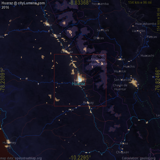
Analysis of Huaraz night lights 2016
Square area 10x10 km:
 4.76%
4.76%90-99
5.84%80-89
2.16%70-79
9.09%60-69
7.36%50-59
4.76%40-49
3.68%30-39
3.25%20-29
4.33%10-19
41.56%0-9
13.2%Square area 50x50 km:
0.19%90-99
0.23%80-89
0.15%70-79
0.92%60-69
0.69%50-59
1.08%40-49
0.75%30-39
0.49%20-29
0.66%10-19
2.91%0-9
91.94%Clear (daylight) street map image can be seen on geolist.org.
Map coordinates:
8° 50' 1.2" South, 78° 13' 51.3" West
9° 31' 40" South, 77° 31' 40" West
10° 13' 13.8" South, 76° 49' 28.8" West
Some cities around Huaraz sort by population:
• Chimbote
125.3 km =77.9 mi,  293°
293°
• Yanacancha
125 km =77.7 mi,  129°
129°
• Huarmey
91 km =56.5 mi,  228°
228°
• Carás
61.7 km =38.3 mi,  330°
330°
• Yauya
65.5 km =40.7 mi,  22°
22°
• San Miguel de Cauri
120.1 km =74.6 mi,  124°
124°
• Yungay
49.4 km =30.7 mi, 331°
• Carhuaz
30.2 km =18.8 mi, 334°
3696378 (p: 86,934)
Sources (retrieved 2019-11-25):
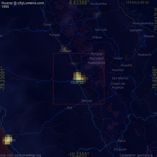
» NASA, Earths city lights 1995
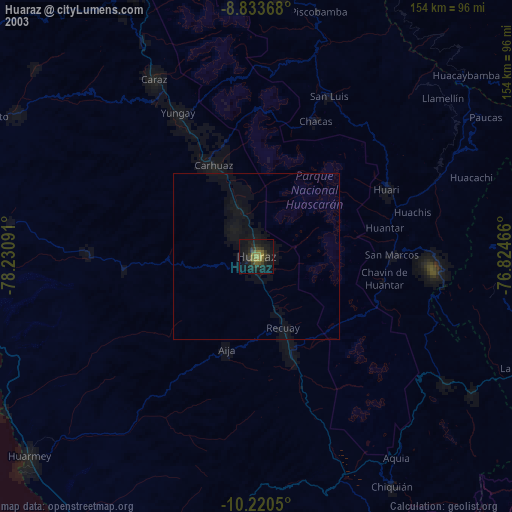
» NASA city lights 2003
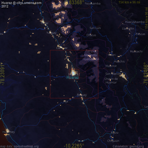
» Earth at Night: Flat Maps 2012, 2016