Moquegua night lights from space
Night Light of Moquegua from space (Peru) Src. Average luminocity for 10x10km area is 33.3471% and for 50x50km: 3.2487%.
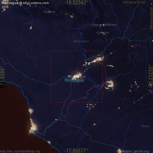
Analysis of Moquegua night lights 2016
Square area 10x10 km:
 4.96%
4.96%90-99
4.75%80-89
5.17%70-79
4.13%60-69
9.5%50-59
2.69%40-49
2.69%30-39
2.48%20-29
2.27%10-19
37.6%0-9
23.76%Square area 50x50 km:
0.32%90-99
0.32%80-89
0.49%70-79
0.34%60-69
0.8%50-59
0.34%40-49
0.29%30-39
0.27%20-29
0.28%10-19
3.17%0-9
93.38%Clear (daylight) street map image can be seen on geolist.org.
Map coordinates:
16° 31' 31.5" South, 71° 38' 19.7" West
17° 11' 54" South, 70° 56' 8.4" West
17° 52' 7.6" South, 70° 13' 57.2" West
Some cities around Moquegua sort by population:
• Arequipa
109.4 km =68 mi,  324°
324°
• Tacna
116 km =72.1 mi,  141°
141°
• Ilo
64.6 km =40.1 mi,  221°
221°
• Ilabaya
51.2 km =31.8 mi,  118°
118°
• Cocachacra
88.2 km =54.8 mi,  277°
277°
• Pacocha
66 km =41 mi, 221°
• Torata
16.7 km =10.4 mi,  36°
36°
• Punta de Bombón
91.1 km =56.6 mi,  271°
271°
3934608 (p: 54,517)
Sources (retrieved 2019-11-25):
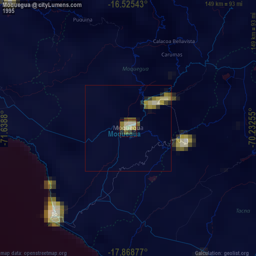
» NASA, Earths city lights 1995
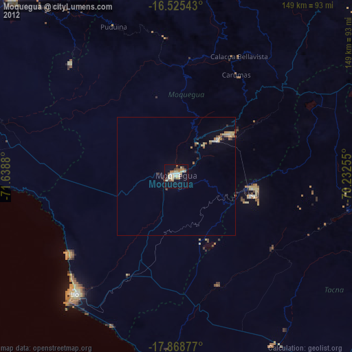
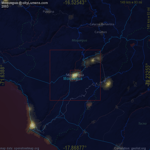
» NASA city lights 2003
» Earth at Night: Flat Maps 2012, 2016