Sohar night lights from space
Night Light of Sohar (Al Batinah North) from space (Oman) Src. Average luminocity for 10x10km area is 78.8988% and for 50x50km: 23.7991%.
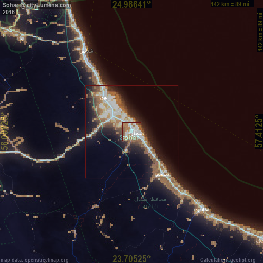

Analysis of Sohar night lights 2016
Square area 10x10 km:
 23.81%
90-99
20.63%80-89
6.35%70-79
5.16%60-69
22.02%50-59
17.26%40-49
2.98%30-39
1.39%20-29
0.4%10-19
0%0-9
0%Square area 50x50 km:
4.11%90-99
4.81%80-89
2.23%70-79
1.81%60-69
4.48%50-59
5.62%40-49
2.89%30-39
3.22%20-29
5.25%10-19
11.17%0-9
54.4%Clear (daylight) street map image can be seen on geolist.org.
Map coordinates:
24° 59' 11.1" North, 56° 0' 22.5" East
24° 20' 50.8" North, 56° 42' 33.7" East
23° 42' 18.9" North, 57° 24' 45" East
Some cities around Sohar sort by population:
• As Suwayq
92.4 km =57.4 mi,  126°
126°
• Şaḩam
26.6 km =16.5 mi,  136°
136°
• Al Fujairah City, AE
93.2 km =57.9 mi,  336°
336°
• Al Buraymī
93.5 km =58.1 mi,  263°
263°
• Al Khābūrah
57.1 km =35.5 mi, 137°
• Shināş
50.3 km =31.3 mi,  330°
330°
• Liwá
25.2 km =15.7 mi,  323°
323°
• Yanqul
86.4 km =53.7 mi,  191°
191°
286282 (p: 108,274)
Sources (retrieved 2019-11-25):
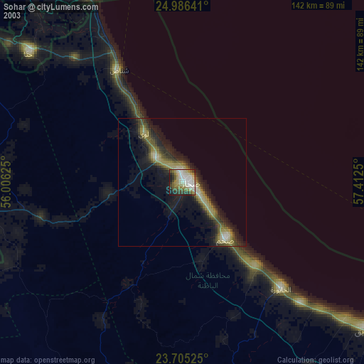
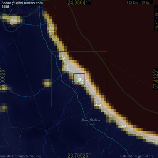
» NASA, Earths city lights 1995
» NASA city lights 2003
» Earth at Night: Flat Maps 2012, 2016