Al Khābūrah night lights from space
Night Light of Al Khābūrah (Al Batinah North) from space (Oman) Src. Average luminocity for 10x10km area is 55.2652% and for 50x50km: 13.3832%.
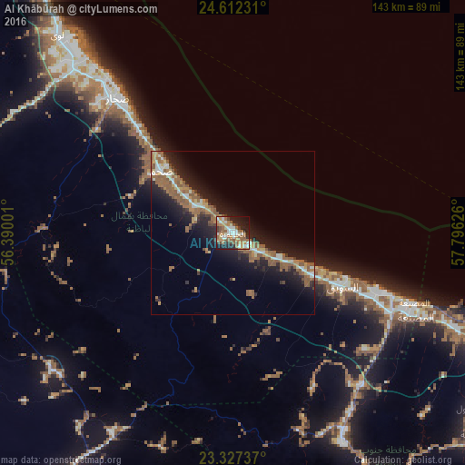
Analysis of Al Khābūrah night lights 2016
Square area 10x10 km:
 8.33%
8.33%90-99
10.42%80-89
4.36%70-79
10.8%60-69
12.88%50-59
14.39%40-49
3.22%30-39
6.06%20-29
13.83%10-19
13.64%0-9
2.08%Square area 50x50 km:
1.1%90-99
1.69%80-89
1.18%70-79
1.54%60-69
3.11%50-59
4.68%40-49
0.62%30-39
1.61%20-29
4.11%10-19
10.7%0-9
69.66%Clear (daylight) street map image can be seen on geolist.org.
Map coordinates:
24° 36' 44.3" North, 56° 23' 24" East
23° 58' 17.2" North, 57° 5' 35.3" East
23° 19' 38.5" North, 57° 47' 46.5" East
Some cities around Al Khābūrah sort by population:
• Sohar
57.1 km =35.5 mi,  317°
317°
• As Suwayq
37.6 km =23.4 mi,  111°
111°
• Şaḩam
30.5 km =19 mi, 317°
• Rustaq
72.8 km =45.2 mi,  152°
152°
• Liwá
82.2 km =51.1 mi, 319°
• Oman Smart Future City
62.5 km =38.8 mi,  124°
124°
• Yanqul
70.7 km =43.9 mi,  232°
232°
• Bayt al ‘Awābī
86.3 km =53.6 mi, 149°
289199 (p: 50,223)
Sources (retrieved 2019-11-25):
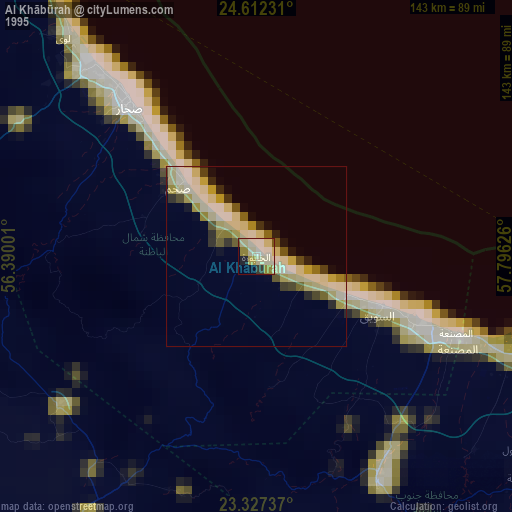
» NASA, Earths city lights 1995
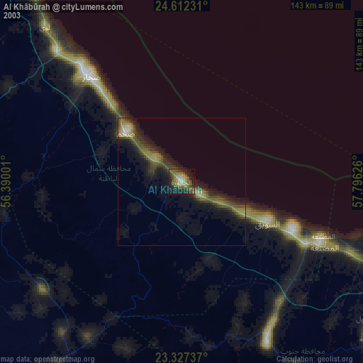
» NASA city lights 2003
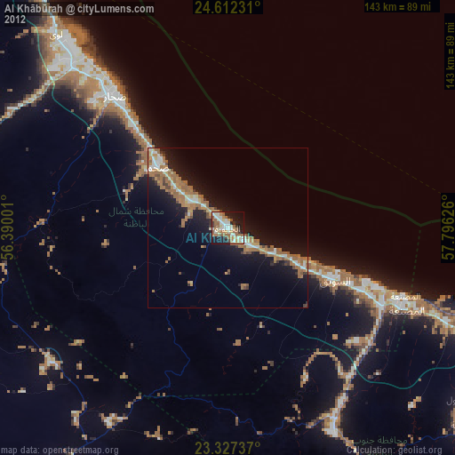
» Earth at Night: Flat Maps 2012, 2016