Yanqul night lights from space
Night Light of Yanqul (Az̧ Z̧āhirah) from space (Oman) Src. Average luminocity for 10x10km area is 32.002% and for 50x50km: 5.6369%.
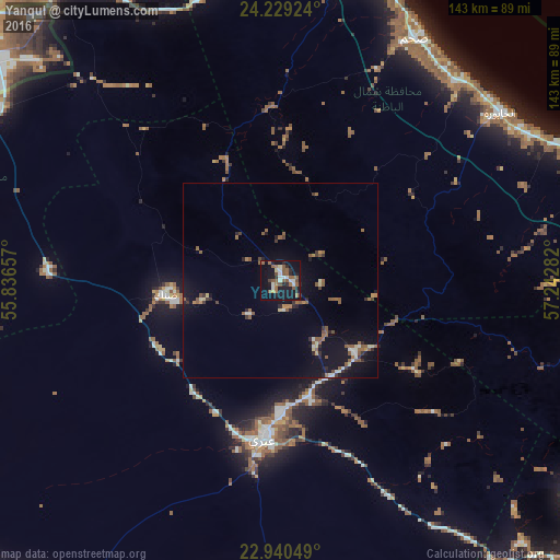
Analysis of Yanqul night lights 2016
Square area 10x10 km:
 5.56%
5.56%90-99
3.17%80-89
1.59%70-79
0.79%60-69
6.15%50-59
13.49%40-49
2.58%30-39
1.98%20-29
6.75%10-19
38.89%0-9
19.05%Square area 50x50 km:
0.44%90-99
0.5%80-89
0.47%70-79
0.2%60-69
0.9%50-59
2.13%40-49
0.37%30-39
0.67%20-29
1.1%10-19
5.82%0-9
87.39%Clear (daylight) street map image can be seen on geolist.org.
Map coordinates:
24° 13' 45.3" North, 55° 50' 11.7" East
23° 35' 11.2" North, 56° 32' 22.9" East
22° 56' 25.8" North, 57° 14' 34.2" East
Some cities around Yanqul sort by population:
• Sohar
86.4 km =53.7 mi,  11°
11°
• As Suwayq
96.1 km =59.7 mi,  72°
72°
• ‘Ibrī
40.2 km =25 mi,  183°
183°
• Şaḩam
74.2 km =46.1 mi,  28°
28°
• Rustaq
92.8 km =57.7 mi,  103°
103°
• Al Ain City, AE
103.9 km =64.6 mi,  310°
310°
• Bahlā’
103.3 km =64.2 mi,  130°
130°
• Al Khābūrah
70.7 km =43.9 mi,  52°
52°
411849 (p: 16,599)
Sources (retrieved 2019-11-25):
» Earth at Night: Flat Maps 2012, 2016