Şalālah night lights from space
Night Light of Şalālah (Dhofar) from space (Oman) Src. Average luminocity for 10x10km area is 88.1342% and for 50x50km: 33.61%.
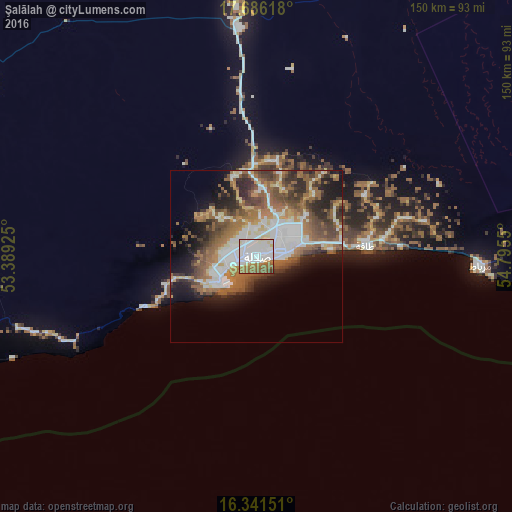
Analysis of Şalālah night lights 2016
Square area 10x10 km:
 45.24%
90-99
21%80-89
5.84%70-79
3.9%60-69
15.8%50-59
6.49%40-49
1.73%30-39
0%20-29
0%10-19
0%0-9
0%Square area 50x50 km:
7.62%90-99
5.9%80-89
2.64%70-79
2.48%60-69
6.53%50-59
7.9%40-49
5.92%30-39
5.04%20-29
6.25%10-19
8.92%0-9
40.8%Clear (daylight) street map image can be seen on geolist.org.
Map coordinates:
17° 41' 10.2" North, 53° 23' 21.3" East
17° 0' 54.2" North, 54° 5' 32.5" East
16° 20' 29.4" North, 54° 47' 43.8" East
Some cities around Şalālah sort by population:
• Mukalla, YE
598.4 km =371.8 mi,  242°
242°
• Adam
696.4 km =432.7 mi,  31°
31°
• Bereeda, SO
658.7 km =409.3 mi,  209°
209°
• Al Ghayz̧ah, YE
223 km =138.6 mi,  246°
246°
• Muzayri‘, AE
682.2 km =423.9 mi,  357°
357°
• Hadibu, YE
485.5 km =301.7 mi,  180°
180°
• Caluula, SO
666.3 km =414 mi, 212°
• Haymā’
400.2 km =248.7 mi,  35°
35°
286621 (p: 163,140)
Sources (retrieved 2019-11-25):
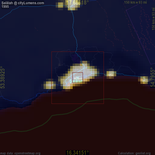
» NASA, Earths city lights 1995
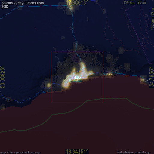
» NASA city lights 2003
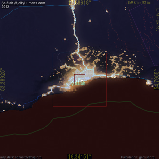
» Earth at Night: Flat Maps 2012, 2016