Adam night lights from space
Night Light of Adam (Ad Dakhiliyah) from space (Oman) Src. Average luminocity for 10x10km area is 37.1231% and for 50x50km: 3.6327%.
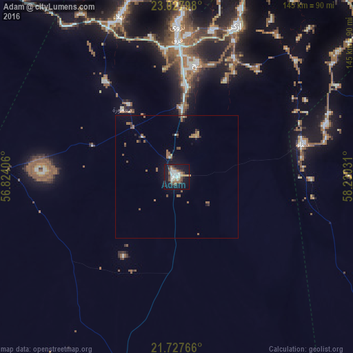
Analysis of Adam night lights 2016
Square area 10x10 km:
 6.25%
6.25%90-99
9.66%80-89
2.46%70-79
3.41%60-69
3.22%50-59
6.06%40-49
5.68%30-39
3.98%20-29
3.22%10-19
45.45%0-9
10.61%Square area 50x50 km:
0.28%90-99
0.49%80-89
0.21%70-79
0.32%60-69
0.7%50-59
1.02%40-49
0.37%30-39
0.37%20-29
0.44%10-19
2.99%0-9
92.81%Clear (daylight) street map image can be seen on geolist.org.
Map coordinates:
23° 1' 40.7" North, 56° 49' 26.6" East
22° 22' 45.6" North, 57° 31' 37.8" East
21° 43' 39.6" North, 58° 13' 49.1" East
Some cities around Adam sort by population:
• Rustaq
113 km =70.2 mi,  354°
354°
• Nizwá
61.6 km =38.3 mi,  0°
0°
• Bahlā’
70.5 km =43.8 mi,  341°
341°
• Sufālat Samā’il
115.7 km =71.9 mi,  25°
25°
• Izkī
66.3 km =41.2 mi,  21°
21°
• Ibrā’
109 km =67.7 mi,  71°
71°
• Al Qābil
121.8 km =75.7 mi,  79°
79°
• Bayt al ‘Awābī
102.7 km =63.8 mi,  359°
359°
289433 (p: 17,283)
Sources (retrieved 2019-11-25):
» Earth at Night: Flat Maps 2012, 2016