Muzayri‘ night lights from space
Night Light of Muzayri‘ (Abu Dhabi) from space (United Arab Emirates) Src. Average luminocity for 10x10km area is 64.3182% and for 50x50km: 12.3868%.
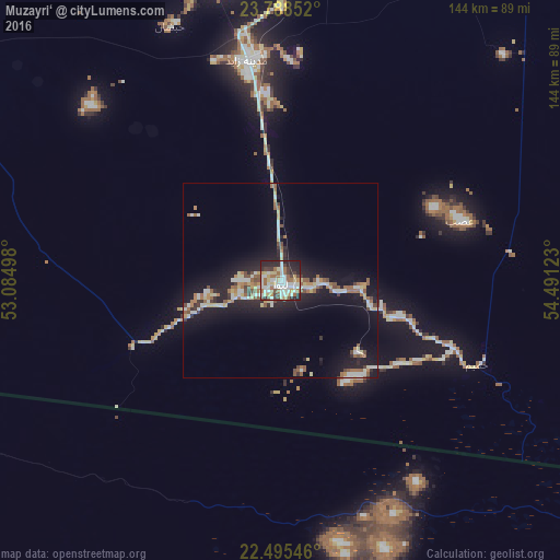
Analysis of Muzayri‘ night lights 2016
Square area 10x10 km:
 11.55%
90-99
20.64%80-89
10.98%70-79
5.49%60-69
9.09%50-59
6.06%40-49
5.87%30-39
7.95%20-29
17.8%10-19
4.55%0-9
0%Square area 50x50 km:
1.41%90-99
2.37%80-89
1.66%70-79
1.03%60-69
1.59%50-59
2.06%40-49
1.26%30-39
1.12%20-29
3.29%10-19
11.62%0-9
72.58%Clear (daylight) street map image can be seen on geolist.org.
Map coordinates:
23° 47' 18.7" North, 53° 5' 5.9" East
23° 8' 36.8" North, 53° 47' 17.2" East
22° 29' 43.7" North, 54° 29' 28.4" East
Some cities around Muzayri‘ sort by population:
• Abu Dhabi
158 km =98.2 mi,  23°
23°
• Musaffah
152.5 km =94.8 mi,  27°
27°
• Khalifah A City
165 km =102.5 mi, 30°
• Bani Yas City
155.4 km =96.6 mi, 33°
• Zayed City
57.4 km =35.7 mi,  351°
351°
• Al Shamkhah City
167.5 km =104.1 mi, 33°
• Al Ain City
232.2 km =144.3 mi,  59°
59°
• Ar Ruways
152.2 km =94.6 mi,  314°
314°
291279 (p: 10,000)
Sources (retrieved 2019-11-25):
» Earth at Night: Flat Maps 2012, 2016