Invercargill night lights from space
Night Light of Invercargill (Southland) from space (New Zealand) Src. Average luminocity for 10x10km area is 28.9301% and for 50x50km: 1.4598%.
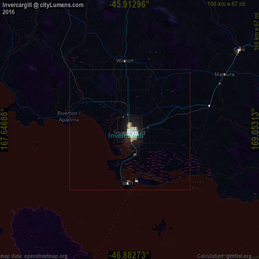
Analysis of Invercargill night lights 2016
Square area 10x10 km:
 5.8%
5.8%90-99
9.67%80-89
1.93%70-79
2.53%60-69
0.89%50-59
2.53%40-49
1.64%30-39
2.53%20-29
2.98%10-19
32.44%0-9
37.05%Square area 50x50 km:
0.24%90-99
0.43%80-89
0.1%70-79
0.1%60-69
0.04%50-59
0.1%40-49
0.12%30-39
0.19%20-29
0.17%10-19
1.63%0-9
96.88%Clear (daylight) street map image can be seen on geolist.org.
Map coordinates:
45° 54' 46.7" South, 167° 38' 48.8" East
46° 24' 0" South, 168° 21' 0" East
46° 52' 57.8" South, 169° 3' 11.3" East
Some cities around Invercargill sort by population:
• Dunedin
175.9 km =109.3 mi,  70°
70°
• Ashburton
384.2 km =238.7 mi,  43°
43°
• Timaru
317.8 km =197.5 mi,  45°
45°
• Oamaru
249.6 km =155.1 mi, 54°
• Gore
56.3 km =35 mi, 54°
• Queenstown
154.2 km =95.8 mi,  9°
9°
• Papatowai
87.6 km =54.4 mi,  101°
101°
• Cromwell
165.2 km =102.7 mi,  23°
23°
2189529 (p: 47,287)
Sources (retrieved 2019-11-25):
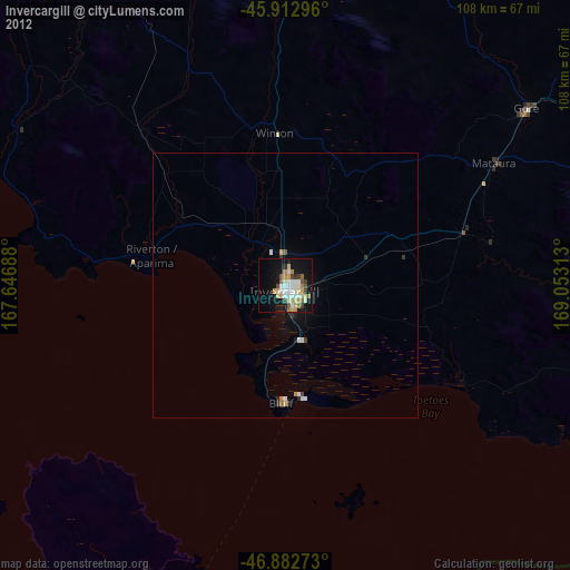
» Earth at Night: Flat Maps 2012, 2016