Dunedin night lights from space
Night Light of Dunedin (Otago) from space (New Zealand) Src. Average luminocity for 10x10km area is 37.4286% and for 50x50km: 2.1479%.
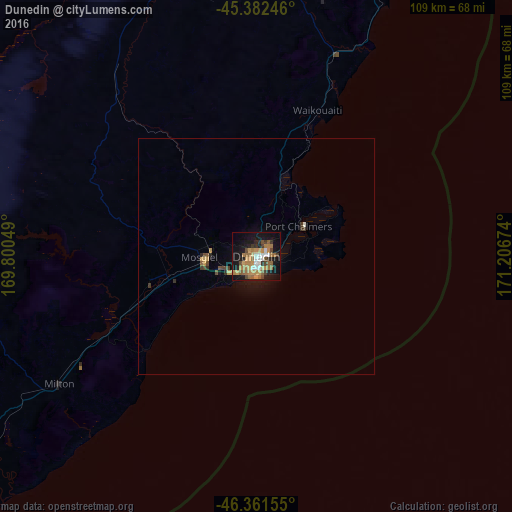
Analysis of Dunedin night lights 2016
Square area 10x10 km:
 4.32%
4.32%90-99
4.02%80-89
1.93%70-79
9.97%60-69
11.16%50-59
5.65%40-49
4.17%30-39
4.76%20-29
4.61%10-19
32.14%0-9
17.26%Square area 50x50 km:
0.17%90-99
0.19%80-89
0.11%70-79
0.53%60-69
0.45%50-59
0.3%40-49
0.34%30-39
0.34%20-29
0.28%10-19
1.9%0-9
95.4%Clear (daylight) street map image can be seen on geolist.org.
Map coordinates:
45° 22' 56.9" South, 169° 48' 1.8" East
45° 52' 27" South, 170° 30' 13" East
46° 21' 41.6" South, 171° 12' 24.3" East
Some cities around Dunedin sort by population:
• Invercargill
175.9 km =109.3 mi,  250°
250°
• Ashburton
240 km =149.1 mi,  23°
23°
• Timaru
174.5 km =108.4 mi, 19°
• Oamaru
93.7 km =58.2 mi, 22°
• Gore
123.2 km =76.6 mi,  258°
258°
• Queenstown
171.5 km =106.6 mi,  303°
303°
• Papatowai
110.2 km =68.5 mi,  226°
226°
• Cromwell
137.7 km =85.6 mi,  312°
312°
2191562 (p: 114,347)
Sources (retrieved 2019-11-25):
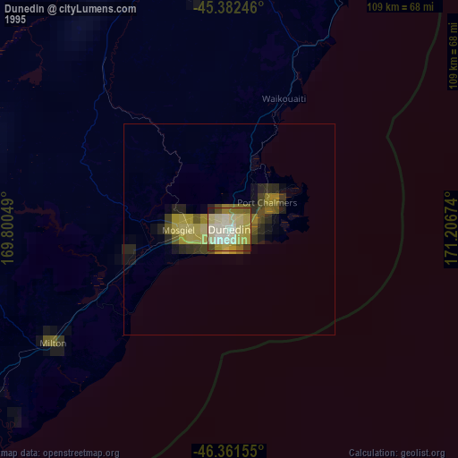
» NASA, Earths city lights 1995
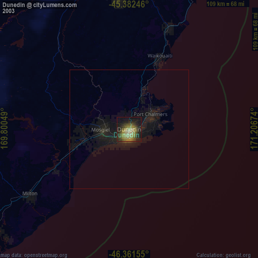
» NASA city lights 2003
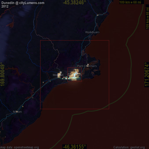
» Earth at Night: Flat Maps 2012, 2016