Greymouth night lights from space
Night Light of Greymouth (West Coast) from space (New Zealand) Src. Average luminocity for 10x10km area is 6.3333% and for 50x50km: 0.301%.
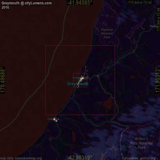
Analysis of Greymouth night lights 2016
Square area 10x10 km:
 0%
0%90-99
0.63%80-89
0%70-79
1.27%60-69
0.63%50-59
0.48%40-49
3.17%30-39
5.08%20-29
0.16%10-19
0%0-9
88.57%Square area 50x50 km:
0%90-99
0.03%80-89
0%70-79
0.05%60-69
0.03%50-59
0.02%40-49
0.13%30-39
0.23%20-29
0.08%10-19
0.05%0-9
99.39%Clear (daylight) street map image can be seen on geolist.org.
Map coordinates:
41° 56' 45.1" South, 170° 29' 48.8" East
42° 28' 0" South, 171° 12' 0" East
42° 58' 59.5" South, 171° 54' 11.3" East
Some cities around Greymouth sort by population:
• Christchurch
166.3 km =103.3 mi,  135°
135°
• Nelson
217.8 km =135.3 mi,  52°
52°
• Ashburton
164.9 km =102.5 mi,  164°
164°
• Timaru
214.6 km =133.3 mi,  178°
178°
• Blenheim
250.8 km =155.8 mi,  65°
65°
• Richmond
206.9 km =128.6 mi, 52°
• Kaiapoi
155 km =96.3 mi,  130°
130°
• Motueka
211.3 km =131.3 mi, 45°
2206895 (p: 9,419)
Sources (retrieved 2019-11-25):
» Earth at Night: Flat Maps 2012, 2016