Christchurch night lights from space
Night Light of Christchurch (Canterbury) from space (New Zealand) Src. Average luminocity for 10x10km area is 87.6873% and for 50x50km: 11.1517%.
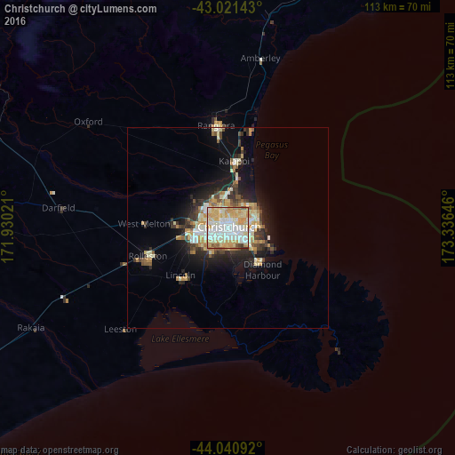


Analysis of Christchurch night lights 2016
Square area 10x10 km:
 22.06%
90-99
30.79%80-89
19.52%70-79
20.63%60-69
3.02%50-59
2.38%40-49
0.95%30-39
0.63%20-29
0%10-19
0%0-9
0%Square area 50x50 km:
1.27%90-99
2.65%80-89
1.73%70-79
2.04%60-69
1%50-59
1.08%40-49
1%30-39
1.73%20-29
2.72%10-19
5.12%0-9
79.66%Clear (daylight) street map image can be seen on geolist.org.
Map coordinates:
43° 1' 17.1" South, 171° 55' 48.8" East
43° 31' 60" South, 172° 37' 60" East
44° 2' 27.3" South, 173° 20' 11.3" East
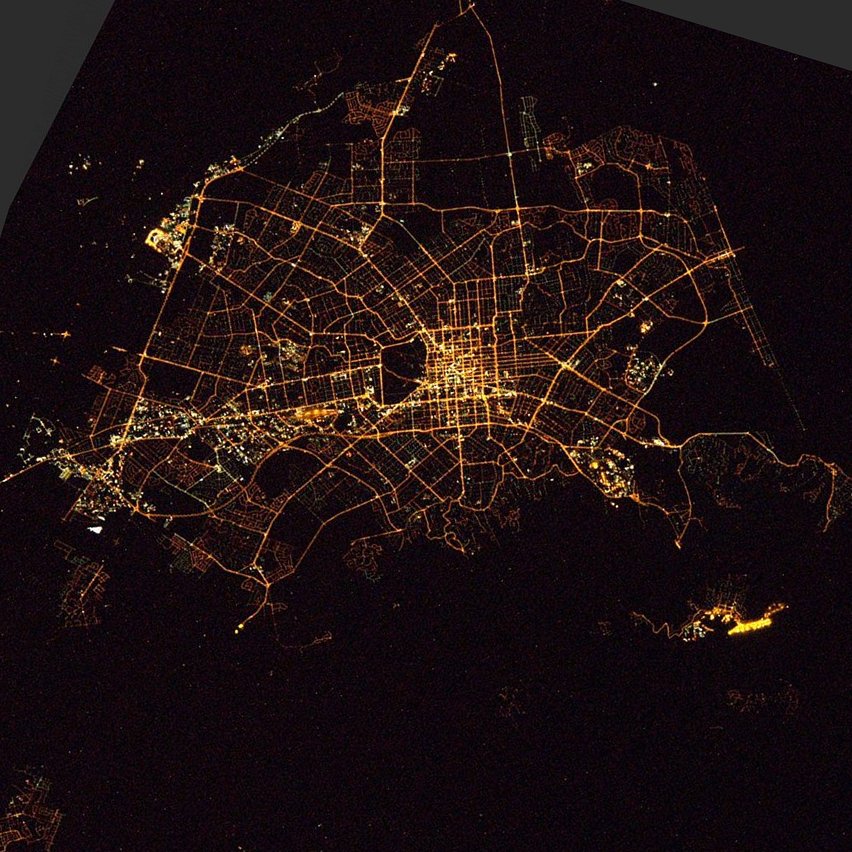
Fantastic image of Christchurch from space taken by astronauts [src2], but I don't have information about it's orientation, scale or angle. If necessary, it was rotated manually, so North points approximately to upper direction. Click to zoom in:
Some cities around Christchurch sort by population:
• Nelson
257.2 km =159.8 mi,  11°
11°
• Ashburton
83.2 km =51.7 mi,  240°
240°
• Timaru
146.3 km =90.9 mi,  228°
228°
• Blenheim
249 km =154.7 mi,  25°
25°
• Richmond
248.7 km =154.5 mi, 10°
• Oamaru
218.5 km =135.8 mi,  217°
217°
• Kaiapoi
17.2 km =10.7 mi,  1°
1°
• Greymouth
166.3 km =103.3 mi,  315°
315°
2192362 (p: 363,926)
Sources (retrieved 2019-11-25):
» NASA, Earths city lights 1995
» NASA city lights 2003
» Earth at Night: Flat Maps 2012, 2016
Src.2: Tim Kopra, Twitter/@astro_tim, 2016-04-14