Nelson night lights from space
Night Light of Nelson from space (New Zealand) Src. Average luminocity for 10x10km area is 23.5016% and for 50x50km: 2.0314%.
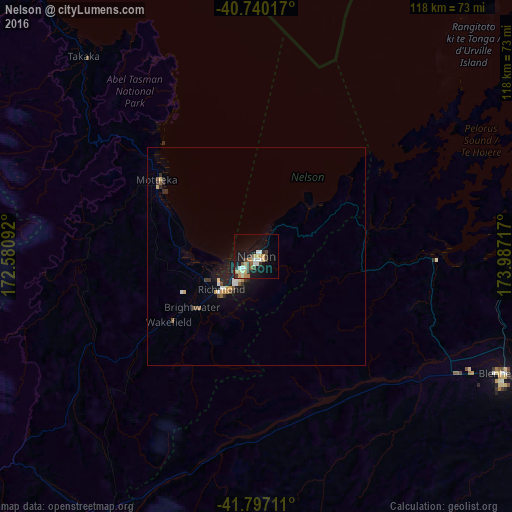

Analysis of Nelson night lights 2016
Square area 10x10 km:
 1.62%
1.62%90-99
6.82%80-89
2.6%70-79
3.25%60-69
2.6%50-59
1.95%40-49
2.76%30-39
4.06%20-29
1.62%10-19
21.92%0-9
50.81%Square area 50x50 km:
0.14%90-99
0.44%80-89
0.19%70-79
0.32%60-69
0.14%50-59
0.21%40-49
0.28%30-39
0.31%20-29
0.28%10-19
2.02%0-9
95.67%Clear (daylight) street map image can be seen on geolist.org.
Map coordinates:
40° 44' 24.6" South, 172° 34' 51.3" East
41° 16' 14.8" South, 173° 17' 2.5" East
41° 47' 49.6" South, 173° 59' 13.8" East
Some cities around Nelson sort by population:
• Wellington
124.6 km =77.4 mi,  90°
90°
• Lower Hutt
136.6 km =84.9 mi, 87°
• Porirua
131.9 km =82 mi,  83°
83°
• Blenheim
62.1 km =38.6 mi,  116°
116°
• Richmond
10.9 km =6.8 mi,  230°
230°
• Khandallah
126.3 km =78.5 mi, 88°
• Motueka
27.1 km =16.8 mi,  304°
304°
• Petone
132.7 km =82.5 mi, 87°
2186280 (p: 59,200)
Sources (retrieved 2019-11-25):
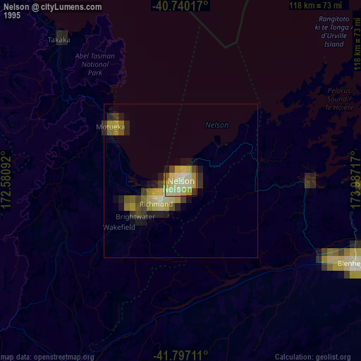
» NASA, Earths city lights 1995
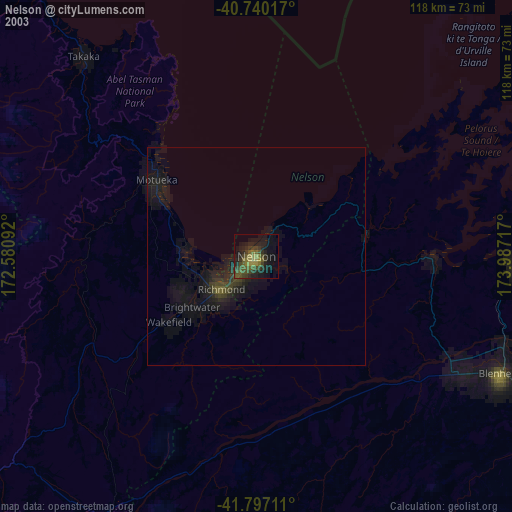
» NASA city lights 2003
» Earth at Night: Flat Maps 2012, 2016