Woudrichem night lights from space
Night Light of Woudrichem (North Brabant) from space (Netherlands) Src. Average luminocity for 10x10km area is 24.3179% and for 50x50km: 26.2034%.
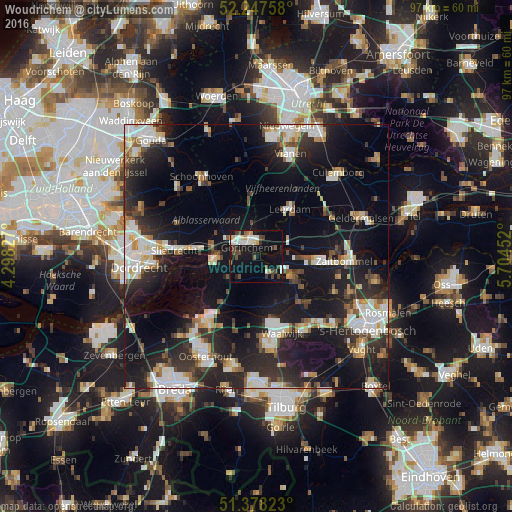
Analysis of Woudrichem night lights 2016
Square area 10x10 km:
 4.2%
4.2%90-99
4.62%80-89
1.54%70-79
2.38%60-69
0.84%50-59
2.52%40-49
6.86%30-39
2.24%20-29
3.36%10-19
21.85%0-9
49.58%Square area 50x50 km:
4.71%90-99
5.43%80-89
2.31%70-79
2.28%60-69
2.18%50-59
2.53%40-49
2.84%30-39
4.12%20-29
9.49%10-19
22.54%0-9
41.57%Clear (daylight) street map image can be seen on geolist.org.
Map coordinates:
52° 14' 51.3" North, 4° 17' 53.8" East
51° 48' 54" North, 5° 0' 5" East
51° 22' 41.6" North, 5° 42' 16.3" East
Some cities around Woudrichem sort by population:
• Waalwijk
15.5 km =9.6 mi,  162°
162°
• Gorinchem
3.1 km =1.9 mi,  320°
320°
• Werkendam
7.4 km =4.6 mi,  265°
265°
• Leerdam
10.7 km =6.6 mi,  35°
35°
• Aalburg
11.2 km =7 mi,  126°
126°
• Neder-Hardinxveld
10.2 km =6.3 mi,  278°
278°
• Giessendam
11.5 km =7.1 mi, 279°
• Waspik
14.8 km =9.2 mi,  195°
195°
2744156 (p: 14,208)
Sources (retrieved 2019-11-25):
» Earth at Night: Flat Maps 2012, 2016