Waspik night lights from space
Night Light of Waspik (North Brabant) from space (Netherlands) Src. Average luminocity for 10x10km area is 20.2941% and for 50x50km: 28.6198%.
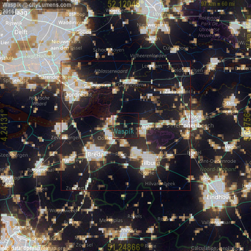
Analysis of Waspik night lights 2016
Square area 10x10 km:
 1.26%
1.26%90-99
1.26%80-89
1.12%70-79
1.82%60-69
1.68%50-59
2.66%40-49
4.34%30-39
2.52%20-29
13.17%10-19
38.94%0-9
31.23%Square area 50x50 km:
5.29%90-99
5.75%80-89
2.56%70-79
2.67%60-69
2.62%50-59
2.65%40-49
3.03%30-39
4.46%20-29
10.38%10-19
26.28%0-9
34.32%Clear (daylight) street map image can be seen on geolist.org.
Map coordinates:
52° 7' 13.7" North, 4° 14' 28.7" East
51° 41' 12" North, 4° 56' 40" East
51° 14' 55.2" North, 5° 38' 51.2" East
Some cities around Waspik sort by population:
• Oosterhout
7.5 km =4.7 mi,  231°
231°
• Waalwijk
8.7 km =5.4 mi,  93°
93°
• Dongen
6.7 km =4.2 mi,  183°
183°
• Loon op Zand
11.2 km =7 mi,  126°
126°
• Geertruidenberg
6.3 km =3.9 mi,  285°
285°
• Rijen
10.8 km =6.7 mi,  189°
189°
• Made
10.5 km =6.5 mi,  263°
263°
• Raamsdonksveer
5 km =3.1 mi,  282°
282°
2744994 (p: 5,120)
Sources (retrieved 2019-11-25):
» Earth at Night: Flat Maps 2012, 2016