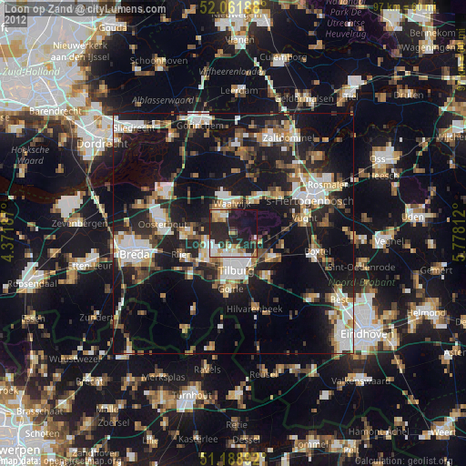
Loon op Zand night lights from space
Night Light of Loon op Zand (North Brabant) from space (Netherlands) Src. Average luminocity for 10x10km area is 42.1885% and for 50x50km: 26.5129%.
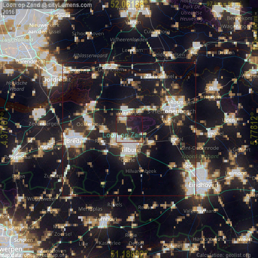
Analysis of Loon op Zand night lights 2016
Square area 10x10 km:
 6.28%
6.28%90-99
10.29%80-89
4.81%70-79
1.87%60-69
4.41%50-59
2.27%40-49
3.74%30-39
10.43%20-29
33.16%10-19
22.73%0-9
0%Square area 50x50 km:
4.79%90-99
5.32%80-89
2.28%70-79
2.38%60-69
2.24%50-59
2.86%40-49
3.01%30-39
4.15%20-29
10.11%10-19
24.23%0-9
38.62%Clear (daylight) street map image can be seen on geolist.org.
Map coordinates:
52° 3' 42.8" North, 4° 22' 18.7" East
51° 37' 39" North, 5° 4' 30" East
51° 11' 20.1" North, 5° 46' 41.2" East
Some cities around Loon op Zand sort by population:
• Tilburg
8.1 km =5 mi,  171°
171°
• Waalwijk
6.1 km =3.8 mi,  357°
357°
• Dongen
9.4 km =5.8 mi,  269°
269°
• Korvel
8.7 km =5.4 mi,  181°
181°
• Udenhout
5.1 km =3.2 mi,  113°
113°
• Broekhoven
8.9 km =5.5 mi, 172°
• De Reit
7.7 km =4.8 mi,  193°
193°
• De Blaak
9.3 km =5.8 mi, 193°
2751456 (p: 23,000)
Sources (retrieved 2019-11-25):
» Earth at Night: Flat Maps 2012, 2016