Korvel night lights from space
Night Light of Korvel (North Brabant) from space (Netherlands) Src. Average luminocity for 10x10km area is 60.6029% and for 50x50km: 25.0635%.
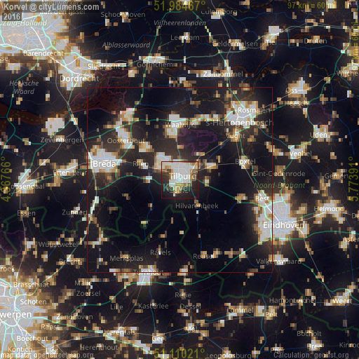
Analysis of Korvel night lights 2016
Square area 10x10 km:
 18.45%
90-99
17.38%80-89
5.35%70-79
6.55%60-69
3.88%50-59
6.02%40-49
4.41%30-39
5.35%20-29
17.38%10-19
14.04%0-9
1.2%Square area 50x50 km:
4.32%90-99
4.79%80-89
2.11%70-79
2.36%60-69
2.24%50-59
2.8%40-49
2.7%30-39
4.19%20-29
10.06%10-19
22.67%0-9
41.76%Clear (daylight) street map image can be seen on geolist.org.
Map coordinates:
51° 59' 4.8" North, 4° 22' 3.6" East
51° 32' 58.3" North, 5° 4' 14.8" East
51° 6' 36.8" North, 5° 46' 26.1" East
Some cities around Korvel sort by population:
• Tilburg
1.6 km =1 mi,  64°
64°
• Goirle
3.2 km =2 mi,  185°
185°
• Hilvarenbeek
8.5 km =5.3 mi,  146°
146°
• Groenewoud
1.8 km =1.1 mi,  132°
132°
• Udenhout
8.3 km =5.2 mi,  36°
36°
• Broekhoven
1.5 km =0.9 mi,  96°
96°
• De Reit
1.9 km =1.2 mi,  309°
309°
• De Blaak
1.8 km =1.1 mi,  258°
258°
2752389 (p: 12,520)
Sources (retrieved 2019-11-25):
» Earth at Night: Flat Maps 2012, 2016