Lindenheuvel night lights from space
Night Light of Lindenheuvel (Limburg) from space (Netherlands) Src. Average luminocity for 10x10km area is 61.1912% and for 50x50km: 28.9276%.
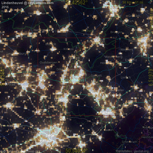
Analysis of Lindenheuvel night lights 2016
Square area 10x10 km:
 14.71%
90-99
16.84%80-89
3.61%70-79
5.61%60-69
8.29%50-59
6.02%40-49
7.35%30-39
18.05%20-29
19.52%10-19
0%0-9
0%Square area 50x50 km:
3.98%90-99
5.43%80-89
2.59%70-79
2.99%60-69
3.84%50-59
4.2%40-49
4.36%30-39
5.72%20-29
10.61%10-19
19.69%0-9
36.58%Clear (daylight) street map image can be seen on geolist.org.
Map coordinates:
51° 25' 32.2" North, 5° 6' 48.7" East
50° 59' 6.3" North, 5° 49' 0" East
50° 32' 25.2" North, 6° 31' 11.2" East
Some cities around Lindenheuvel sort by population:
• Sittard
4 km =2.5 mi,  68°
68°
• Maasmechelen, BE
8.8 km =5.5 mi,  255°
255°
• Geleen
1.5 km =0.9 mi,  144°
144°
• Hoensbroek
10.2 km =6.3 mi,  131°
131°
• Stein
3.9 km =2.4 mi,  243°
243°
• Beek
5.1 km =3.2 mi,  195°
195°
• Elsloo
5.1 km =3.2 mi,  218°
218°
• Bunde
11.5 km =7.1 mi,  211°
211°
2751583 (p: 8,040)
Sources (retrieved 2019-11-25):
» Earth at Night: Flat Maps 2012, 2016