Geleen night lights from space
Night Light of Geleen (Limburg) from space (Netherlands) Src. Average luminocity for 10x10km area is 60.2087% and for 50x50km: 28.9204%.
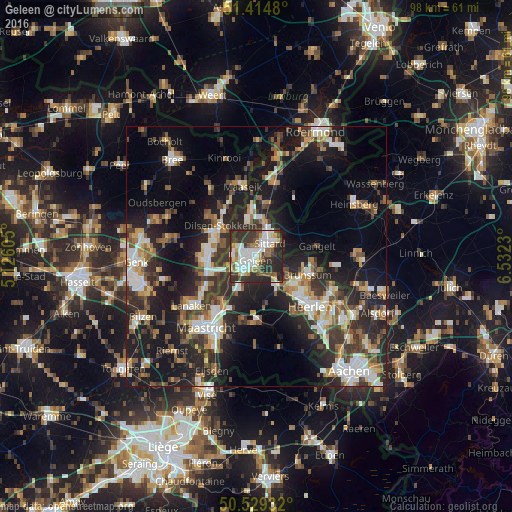
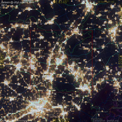
Analysis of Geleen night lights 2016
Square area 10x10 km:
 14.01%
90-99
16.53%80-89
4.62%70-79
6.02%60-69
7.7%50-59
5.32%40-49
7.14%30-39
14.43%20-29
23.25%10-19
0.98%0-9
0%Square area 50x50 km:
4%90-99
5.4%80-89
2.62%70-79
2.97%60-69
3.79%50-59
4.19%40-49
4.41%30-39
5.7%20-29
10.91%10-19
19.73%0-9
36.29%Clear (daylight) street map image can be seen on geolist.org.
Map coordinates:
51° 24' 53.3" North, 5° 7' 33.8" East
50° 58' 27" North, 5° 49' 45" East
50° 31' 45.6" North, 6° 31' 56.3" East
Some cities around Geleen sort by population:
• Sittard
3.9 km =2.4 mi,  46°
46°
• Maasmechelen, BE
9.5 km =5.9 mi,  264°
264°
• Brunssum
10.4 km =6.5 mi,  107°
107°
• Hoensbroek
8.8 km =5.5 mi,  129°
129°
• Stein
4.4 km =2.7 mi, 262°
• Beek
4.3 km =2.7 mi,  211°
211°
• Lindenheuvel
1.5 km =0.9 mi,  324°
324°
• Elsloo
4.9 km =3 mi,  235°
235°
2755616 (p: 32,790)
Sources (retrieved 2019-11-25):
» Earth at Night: Flat Maps 2012, 2016