Hoensbroek night lights from space
Night Light of Hoensbroek (Limburg) from space (Netherlands) Src. Average luminocity for 10x10km area is 49.9272% and for 50x50km: 26.7904%.
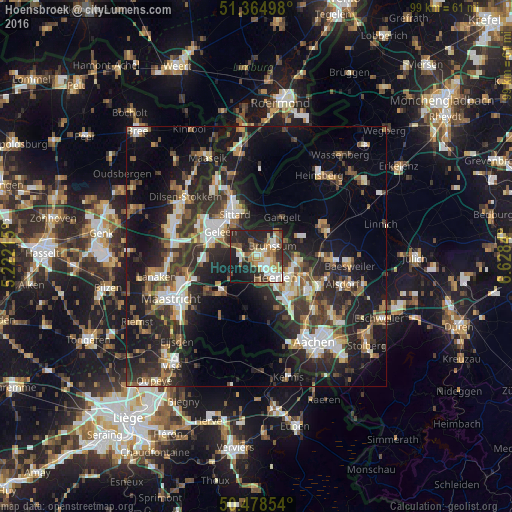
Analysis of Hoensbroek night lights 2016
Square area 10x10 km:
 5.18%
5.18%90-99
13.87%80-89
5.04%70-79
7.84%60-69
7.14%50-59
8.54%40-49
3.5%30-39
7.28%20-29
23.81%10-19
16.25%0-9
1.54%Square area 50x50 km:
3.52%90-99
4.76%80-89
2.28%70-79
2.59%60-69
3.47%50-59
4.01%40-49
4.21%30-39
5.53%20-29
10.85%10-19
19.29%0-9
39.48%Clear (daylight) street map image can be seen on geolist.org.
Map coordinates:
51° 21' 53.9" North, 5° 13' 19.7" East
50° 55' 25.9" North, 5° 55' 31" East
50° 28' 42.7" North, 6° 37' 42.2" East
Some cities around Hoensbroek sort by population:
• Heerlen
6 km =3.7 mi,  138°
138°
• Sittard
9.2 km =5.7 mi,  334°
334°
• Geleen
8.8 km =5.5 mi,  309°
309°
• Brunssum
4.1 km =2.5 mi,  51°
51°
• Gangelt, DE
9.2 km =5.7 mi,  33°
33°
• Beek
9.2 km =5.7 mi,  281°
281°
• Lindenheuvel
10.2 km =6.3 mi, 311°
• Elsloo
11.2 km =7 mi, 284°
2753996 (p: 25,000)
Sources (retrieved 2019-11-25):
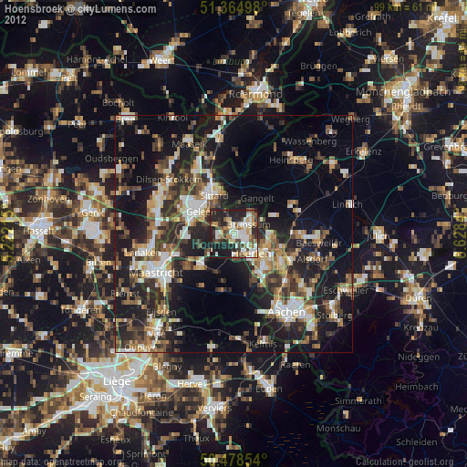
» Earth at Night: Flat Maps 2012, 2016