Sittard night lights from space
Night Light of Sittard (Limburg) from space (Netherlands) Src. Average luminocity for 10x10km area is 45.5107% and for 50x50km: 26.9058%.
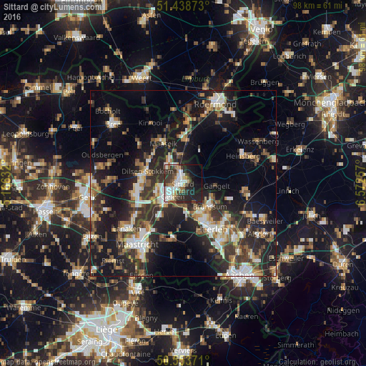
Analysis of Sittard night lights 2016
Square area 10x10 km:
 9.63%
9.63%90-99
12.57%80-89
2.54%70-79
2.94%60-69
6.68%50-59
2.41%40-49
5.61%30-39
11.23%20-29
17.78%10-19
18.58%0-9
10.03%Square area 50x50 km:
3.33%90-99
4.78%80-89
2.46%70-79
2.72%60-69
3.58%50-59
3.99%40-49
4.24%30-39
5.4%20-29
10.36%10-19
19.54%0-9
39.59%Clear (daylight) street map image can be seen on geolist.org.
Map coordinates:
51° 26' 19.4" North, 5° 9' 58.8" East
50° 59' 54" North, 5° 52' 10" East
50° 33' 13.4" North, 6° 34' 21.3" East
Some cities around Sittard sort by population:
• Geleen
3.9 km =2.4 mi,  226°
226°
• Brunssum
9.1 km =5.7 mi,  128°
128°
• Hoensbroek
9.2 km =5.7 mi,  154°
154°
• Gangelt, DE
9 km =5.6 mi,  94°
94°
• Stein
7.9 km =4.9 mi,  245°
245°
• Beek
8.2 km =5.1 mi,  218°
218°
• Lindenheuvel
4 km =2.5 mi, 248°
• Elsloo
8.8 km =5.5 mi, 231°
2747203 (p: 48,400)
Sources (retrieved 2019-11-25):
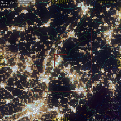
» Earth at Night: Flat Maps 2012, 2016