Umunede night lights from space
Night Light of Umunede (Delta) from space (Nigeria) Src. Average luminocity for 10x10km area is 0% and for 50x50km: 0.0351%.
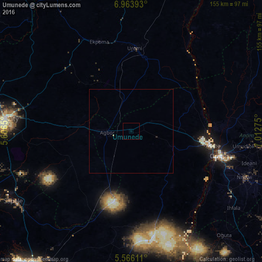
Analysis of Umunede night lights 2016
Square area 10x10 km:
100  0%
0%
90-99 0%
80-89 0%
70-79 0%
60-69 0%
50-59 0%
40-49 0%
30-39 0%
20-29 0%
10-19 0%
0-9 100%
0%90-99
0%80-89
0%70-79
0%60-69
0%50-59
0%40-49
0%30-39
0%20-29
0%10-19
0%0-9
100%Square area 50x50 km:
100 0%
90-99 0%
80-89 0%
70-79 0%
60-69 0.03%
50-59 0%
40-49 0%
30-39 0%
20-29 0.03%
10-19 0%
0-9 99.93%
0%90-99
0%80-89
0%70-79
0%60-69
0.03%50-59
0%40-49
0%30-39
0%20-29
0.03%10-19
0%0-9
99.93%Clear (daylight) street map image can be seen on geolist.org.
Map coordinates:
6° 57' 50.1" North, 5° 36' 23.4" East
6° 15' 55.8" North, 6° 18' 34.6" East
5° 33' 58" North, 7° 0' 45.9" East
Some cities around Umunede sort by population:
• Onitsha
54.2 km =33.7 mi,  103°
103°
• Atani
56 km =34.8 mi,  120°
120°
• Uromi
48.4 km =30.1 mi,  3°
3°
• Asaba
47.3 km =29.4 mi, 99°
• Agbor
12.8 km =8 mi,  264°
264°
• Ogwashi-Uku
25.7 km =16 mi,  112°
112°
• Ubiaja
44.2 km =27.5 mi,  10°
10°
• Obiaruku
49.7 km =30.9 mi,  200°
200°
2320417 (p: 8,331)
Sources (retrieved 2019-11-25):
» Earth at Night: Flat Maps 2012, 2016