Ubiaja night lights from space
Night Light of Ubiaja (Edo) from space (Nigeria) Src. Average luminocity for 10x10km area is 0.2446% and for 50x50km: 0.1084%.
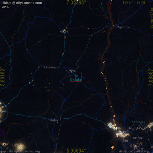
Analysis of Ubiaja night lights 2016
Square area 10x10 km:
100  0%
0%
90-99 0%
80-89 0%
70-79 0%
60-69 0%
50-59 0%
40-49 0.22%
30-39 0%
20-29 0.43%
10-19 0%
0-9 99.35%
0%90-99
0%80-89
0%70-79
0%60-69
0%50-59
0%40-49
0.22%30-39
0%20-29
0.43%10-19
0%0-9
99.35%Square area 50x50 km:
100 0%
90-99 0%
80-89 0%
70-79 0%
60-69 0%
50-59 0%
40-49 0.05%
30-39 0.09%
20-29 0.08%
10-19 0.13%
0-9 99.65%
0%90-99
0%80-89
0%70-79
0%60-69
0%50-59
0%40-49
0.05%30-39
0.09%20-29
0.08%10-19
0.13%0-9
99.65%Clear (daylight) street map image can be seen on geolist.org.
Map coordinates:
7° 21' 13.2" North, 5° 40' 54.6" East
6° 39' 20.9" North, 6° 23' 5.8" East
5° 57' 25" North, 7° 5' 17.1" East
Some cities around Ubiaja sort by population:
• Uromi
7.5 km =4.7 mi,  310°
310°
• Agbor
49.4 km =30.7 mi,  205°
205°
• Auchi
47.7 km =29.6 mi,  343°
343°
• Ekpoma
28.7 km =17.8 mi,  289°
289°
• Ogwashi-Uku
55.3 km =34.4 mi,  163°
163°
• Agenebode
60.5 km =37.6 mi,  34°
34°
• Umunede
44.2 km =27.5 mi,  190°
190°
• Illushi
27 km =16.8 mi,  86°
86°
2321031 (p: 21,782)
Sources (retrieved 2019-11-25):
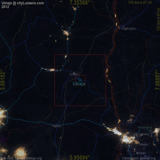
» Earth at Night: Flat Maps 2012, 2016