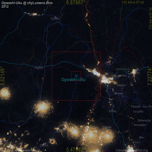
Ogwashi-Uku night lights from space
Night Light of Ogwashi-Uku (Delta) from space (Nigeria) Src. Average luminocity for 10x10km area is 0% and for 50x50km: 2.2727%.
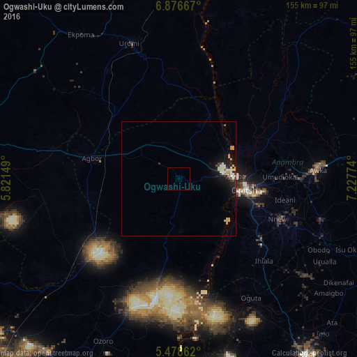
Analysis of Ogwashi-Uku night lights 2016
Square area 10x10 km:
100  0%
0%
90-99 0%
80-89 0%
70-79 0%
60-69 0%
50-59 0%
40-49 0%
30-39 0%
20-29 0%
10-19 0%
0-9 100%
0%90-99
0%80-89
0%70-79
0%60-69
0%50-59
0%40-49
0%30-39
0%20-29
0%10-19
0%0-9
100%Square area 50x50 km:
100 0.15%
90-99 0.56%
80-89 0.38%
70-79 0.44%
60-69 0.08%
50-59 0.09%
40-49 0.26%
30-39 0.15%
20-29 0.43%
10-19 2.39%
0-9 95.07%
0.15%90-99
0.56%80-89
0.38%70-79
0.44%60-69
0.08%50-59
0.09%40-49
0.26%30-39
0.15%20-29
0.43%10-19
2.39%0-9
95.07%Clear (daylight) street map image can be seen on geolist.org.
Map coordinates:
6° 52' 36" North, 5° 49' 17.4" East
6° 10' 41.2" North, 6° 31' 28.6" East
5° 28' 43" North, 7° 13' 39.9" East
Some cities around Ogwashi-Uku sort by population:
• Onitsha
29 km =18 mi,  96°
96°
• Atani
30.8 km =19.1 mi,  126°
126°
• Nnewi
46.9 km =29.1 mi,  112°
112°
• Nkpor
33.9 km =21.1 mi, 95°
• Ozubulu
43.8 km =27.2 mi,  124°
124°
• Asaba
23 km =14.3 mi,  84°
84°
• Agbor
37.5 km =23.3 mi,  282°
282°
• Umunede
25.7 km =16 mi,  292°
292°
2327513 (p: 26,137)
Sources (retrieved 2019-11-25):
» Earth at Night: Flat Maps 2012, 2016