Ekpoma night lights from space
Night Light of Ekpoma (Edo) from space (Nigeria) Src. Average luminocity for 10x10km area is 0.2186% and for 50x50km: 0.3001%.
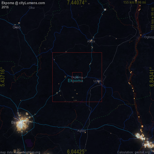
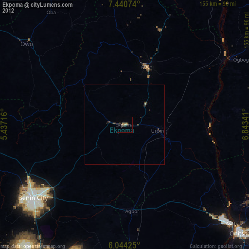
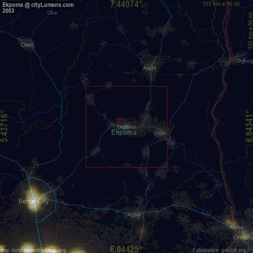
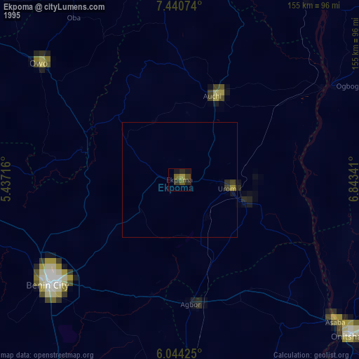
Analysis of Ekpoma night lights 2016
Square area 10x10 km:
 0%
0%90-99
0%80-89
0%70-79
0%60-69
0%50-59
0%40-49
0%30-39
0%20-29
0.65%10-19
0.22%0-9
99.13%Square area 50x50 km:
0%90-99
0%80-89
0%70-79
0%60-69
0%50-59
0.03%40-49
0.1%30-39
0.3%20-29
0.29%10-19
0.17%0-9
99.1%Clear (daylight) street map image can be seen on geolist.org.
Map coordinates:
7° 26' 26.7" North, 5° 26' 13.8" East
6° 44' 34.8" North, 6° 8' 25" East
6° 2' 39.3" North, 6° 50' 36.3" East
Some cities around Ekpoma sort by population:
• Uromi
21.8 km =13.5 mi,  102°
102°
• Agbor
54.7 km =34 mi,  173°
173°
• Auchi
38.6 km =24 mi,  20°
20°
• Ubiaja
28.7 km =17.8 mi,  109°
109°
• Igarra
61.4 km =38.2 mi,  356°
356°
• Umunede
56.3 km =35 mi,  160°
160°
• Ifon
45.5 km =28.3 mi,  297°
297°
• Illushi
54.6 km =33.9 mi, 98°
2343641 (p: 59,618)
Sources (retrieved 2019-11-25):
» NASA, Earths city lights 1995
» NASA city lights 2003
» Earth at Night: Flat Maps 2012, 2016