Jebba night lights from space
Night Light of Jebba (Kwara) from space (Nigeria) Src. Average luminocity for 10x10km area is 6.7835% and for 50x50km: 0.5337%.
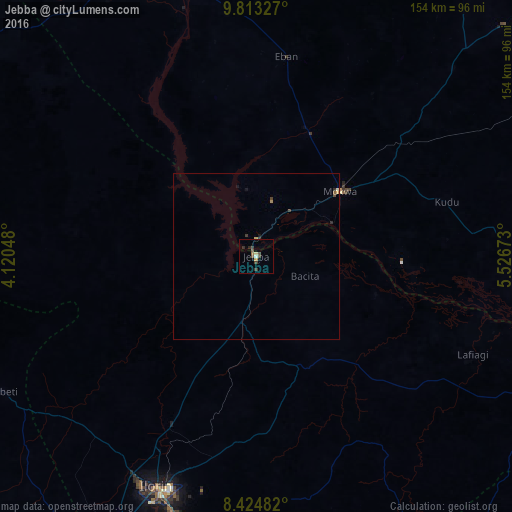
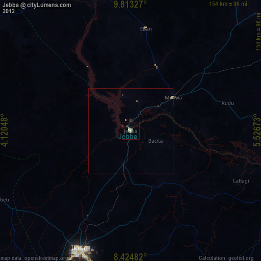
Analysis of Jebba night lights 2016
Square area 10x10 km:
100  0.22%
0.22%
90-99 0.65%
80-89 0.87%
70-79 0.87%
60-69 0.43%
50-59 1.3%
40-49 1.95%
30-39 3.46%
20-29 1.52%
10-19 0%
0-9 88.74%
0.22%90-99
0.65%80-89
0.87%70-79
0.87%60-69
0.43%50-59
1.3%40-49
1.95%30-39
3.46%20-29
1.52%10-19
0%0-9
88.74%Square area 50x50 km:
100 0.01%
90-99 0.03%
80-89 0.08%
70-79 0.08%
60-69 0.05%
50-59 0.08%
40-49 0.11%
30-39 0.27%
20-29 0.13%
10-19 0.1%
0-9 99.05%
0.01%90-99
0.03%80-89
0.08%70-79
0.08%60-69
0.05%50-59
0.08%40-49
0.11%30-39
0.27%20-29
0.13%10-19
0.1%0-9
99.05%Clear (daylight) street map image can be seen on geolist.org.
Map coordinates:
9° 48' 47.8" North, 4° 7' 13.7" East
9° 7' 11" North, 4° 49' 25" East
8° 25' 29.4" North, 5° 31' 36.2" East
Some cities around Jebba sort by population:
• Ilorin
75.9 km =47.2 mi,  204°
204°
• Lafiagi
71.5 km =44.4 mi,  114°
114°
• Igbeti
86.5 km =53.7 mi,  241°
241°
• Mokwa
31.9 km =19.8 mi,  52°
52°
• Bode Saadu
20.6 km =12.8 mi,  192°
192°
• Wawa
97.7 km =60.7 mi,  332°
332°
• Alapa
73.9 km =45.9 mi,  220°
220°
• Bokani
54.1 km =33.6 mi, 49°
2336251 (p: 21,488)
Sources (retrieved 2019-11-25):
» Earth at Night: Flat Maps 2012, 2016